Cliff jumper, South Point, Na'alehu, Big Island - Monday, March 10, 2025

Cliff jumper, South Point, Na'alehu, Big Island - Monday, March 10, 2025

Saturday, August 3, 2019

A Festival of Fools - Saturday, August 3, 2109

Originally, we had planned to go on 9S to cross Lake Champlain at the Lake Champlain Bridge at Crown Point. When I looked at the Rand McNally Trucker's Atlas, I saw one low bridge at 10' 6" (a no-go for us) and another low bridge at 12' 7" (a very close call). 

We did an immediate re-route. We headed north on I-87 to Rouses Point and crossed into Vermont. From there, we followed the signs to I-89 south to Burlington. 
Lake Champlain from Rouses Point, New York.
The bridge that will take us from
New York into Vermont.
Rouses Point, New York.
As we were crossing the bridge from Rouses Point, New York, to Vermont, Bob spotted a fort and I was able to snap a pic of it from the passenger side across the driver's side. This is Fort Montgomery. 


Fort Montgomery, Rouses Point, New York.
Construction was started on the original fort in 1844. Errors were made and it became known as Fort Blunder. You see, the U.S. engineering team had built a fort to keep out Canadians, but they built it in Canada! Oops. 

According to the New England Historical Society website: 
"The U.S. fixed the problem, not by moving the fort, but by moving the boundary line. 
 "After the bloodless and farcical Aroostook War, Daniel Webster in 1842 negotiated the Webster-Ashburton Treaty. The treaty moved the border north."
The fort has been for sale for years. If you would like to own a historical fort, here is a link to it: https://www.privateislandsonline.com/united-states/newyork/fort-montgomery-newyork   or  https://www.plattsburgh-realestate.com/LF0295_Plattsburgh.htm

The roads were fine, but not much shoulder in a few places. We did see a sight that I hope never to see again. Ahead of us, we saw a police car partially in our lane, a line of cars slowing down, a semi-truck stopped on the opposite side of the two-lane road, and a few other cars pulled over helping. We don't know what happened, but there was a person lying on the side of the road face down with a pool of blood around their head. It looked like it must have just happened. And it did not look good. An ambulance had not arrived yet. That was awful!

The worst part of the drive was going through downtown Burlington on Main St. It narrows to one lane and it was bumper-to-bumper traffic. This, we had been told, was the best way to North Beach Campground. The reason is that a big rig has a better turning radius from Main St. onto Battery St. north because you're turning onto a four-lane road. Trust me, you do not want to be driving a big rig through Burlington unless you know where you're going. There are a lot of very narrow streets! It was difficult in many places just to drive our Ford F350 long bed pickup through there without the 5th wheel attached.

Check-in time wasn't until 3:00 p.m. We arrived at 11:45 a.m. We were told to call the campground at noon and if the site was empty we could check in early. Thankfully, there was a big, mostly empty school parking lot where two other RVs were waiting for their sites. We joined them. The school's mascot is the seahorse and I got a good photo of it.


Seahorse mascot on the side of the school.
Just a touch past noon, I called the North Beach Campground office and was told our site was available. We headed the block to the entrance and checked in. Oh my goodness. We had no idea that North Beach Campground was so popular with the locals. There is a really nice swimming beach there that the local people frequent. While we were parked on the side and in the office checking in, a line of cars formed beside us to pay to get into the beach park. When we came out of the office, we had to wait while they went by us. Finally, a nice lady in line waved for us to go in front of her. Sheesh! We were there before all of them.
Our site at North Beach Campground. We backed
up to the exit road and it was busy until the
park closed.
After the 120-mile drive from Wilmington, New York, to Burlington, Vermont, we were happy to set up camp and start walking. Because of the Festival of Fools going on this weekend, we did not want to try to find parking for the truck downtown. It is 1-1/2 miles each way on the bike path from the campground to town and back, making this a 5k distance before we even started our 5k Volksmarch in downtown. We're used to 10k walks, so we figured we could handle it. Our main concerns were that it would get dark before we got back to the campground, and rain was in the forecast for 10:00 p.m. We took flashlights, and I took an umbrella.

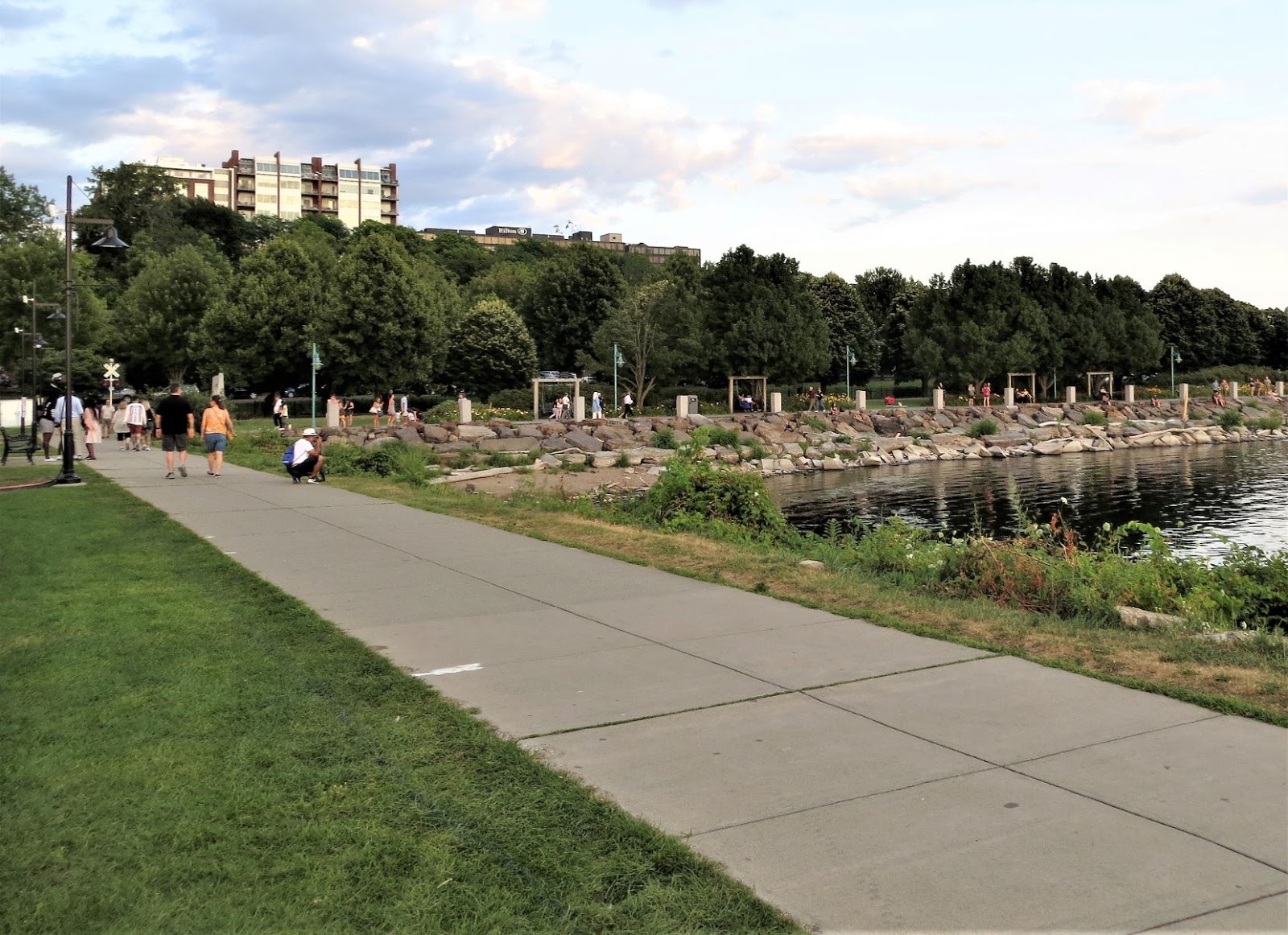
The bike path along Lake Champlain is very pleasant. There was a light, cool breeze coming off the lake. In addition, a hot air balloon touched its basket into the lake and took off again. Across the lake were the layers of the Adirondack Mountains. The sun was going down and made purple and gray shadows along the peaks in New York.

Hot air balloon touching Lake Champlain.
And then it lifted off again.
Looking across Lake Champlain at dusk and
enjoying the silhouettes of the Adirondacks.
Lighthouse at Burlington, Vermont.
People taking an evening dip in the lake.
We found out there's a Dragon Boat Festival
this weekend as well.
Dragon boats at the dock.
Dragon boats at dusk.
Almost sunset, almost heaven.
Dragon boats waiting for a race tomorrow.
Sunset over Lake Champlain.
 We made it to Waterfront Park; time to start our 5k Volksmarch. 


Waterfront Park.
As we were walking to the Hilton Hotel start point, I glanced over at a building and saw a flying monkey. What's that doing here? Bob thought it was a griffon, but I said, "No, it's definitely a flying monkey." Hmm.


Flying monkey on top of the old
Burlington train depot.

From the Hilton Hotel, we walked through Battery Park which was a military camp in the War of 1812. A British ship attacked the shore here in August 1813. Burlington was successfully defended from this point. The skirmish lasted about 20 minutes.


Battery Park history.
Below is a statue of William Wells, a highly decorated Civil War soldier and an officer who was promoted to brevet major general of the volunteers. Congress awarded Wells a Medal of Honor for "distinguished gallantry at the battle of Gettysburg, July 3, 1863."
Statue of William Wells
We almost missed a statue of interest to me, "Chief Grey Lock" by Peter Wolf Toth. It was not mentioned in the walk instructions and it was hiding in the trees. Peter Toth gave one sculpture of a chief to each of the 50 states. We saw one in the Upper Peninsula of Michigan in 2014. Some of his statues have not survived.

Me with Toth's "Chief Grey Lock" statue. 
A Lake Champlain mood photo at dusk.
The steeple of the Unitarian
Church dating from 1816.
The red Romanesque Masonic Temple from 1897.
Richardson Building (formerly
Abernathy's Department Store).
We turned onto Church Street, a pedestrian marketplace, where the Festival of Fools is taking place. The schedule included many bands and singers, jugglers, "The Flyin' Hawaiian," and other street buskers. We modified our walk at this point so we could hang around Church Street Marketplace and the Festival of Fools. It was past our dinnertime, so we chose to eat at Manhattan Pizza and Pub. The pizza was very good.

We saw a couple of these fish drinking fountains.
By this time, it was dark. We did one last survey of the Festival of Fools and decided we better head back to the campground. It was 8:45 p.m. and the weather forecast was for rain and a thunderstorm at 10:00 p.m.

Festival of Fools at Church Street Marketplace.
Ben & Jerry's started in Burlington, but not at this location.
The original gas station they were in is no longer there.
Part of a block-long mural on an outdoor store.
Burlington's City Hall.
When we returned to Waterfront Park and the bike path along Lake Champlain, we were very happy we had lights. Bob had his headlamp that clips onto his baseball cap and I had a flashlight. It was very dark there. 

We weren't the only ones on the bike path. A couple of groups of bike riders came from behind us in the dark and we faced our lights so they could see us, but not blind them. At one point, we heard a large canine come racing at us, barking and snarling. It really freaked us out, but then we remembered there was a dog park along this section with a big fence around it. The owner called the dog back and we relaxed.

At 9:45 p.m. it started sprinkling light, refreshing drops that cooled us a little. We had about 3/4 mile back to our 5th wheel. No other people were out on the path by this time. The raindrops increased in size and frequency. Still about 1/4 mile to our 5th wheel. I put up the umbrella. Bob had his baseball cap on and said he didn't need the umbrella. 

By this time, the rain was coming down steadily and getting stronger. Then we had thunder and lightning, not much, but enough to make me nervous carrying a metal umbrella.

The 5th wheel was a welcome sight and we bee-lined for it. The weather forecasters were right about the timing of the rain. I'm glad we got back when we did. All was well.

Friday, August 2, 2019

Whiteface Mountaintop and Waterfalls - Friday, August 2, 2019

A visit to the Lake Placid/Wilmington area of upstate New York is not complete without a drive to the top of Whiteface Mountain. In 2019, you'll pay $25 for your car and two people for the honor. (No large RVs!) 

The road is open from 8:45 a.m. to 5:00 p.m., and you have to be out of the gate by 6:15 p.m. At the entrance gate, they post the temperature at the top of the mountain, the weather, and visibility. Today, we will be able to see 50 miles (part of Canada and we will see Lake Champlain).

As we drive up and up, the plant life changes. The higher we go, the smaller the trees and plants get. This is because of the harsh weather conditions up high. Trees are stunted due to the short growing season.


I am fascinated by these pine cones that
grow straight up in clusters.
Looking up to the top of Whiteface Mountain.
Beauty looks great from this vantage point!
As soon as you arrive at the parking lot, the attendant has you go all the way to the end by the gift shop, turn around, and come back down to the angled parking spots. 

After you are parked, you have two choices for how to get to the top of the mountain: elevator ride up 27 floors or hike 1/5 mile up a steep trail. We opted to walk through the 426' tunnel to the elevator and save our soles for hiking later today.
Bob ready to enter the tunnel.
Our adventure continues into the mountain!
Mountain identifier sign at the summit.
I'm glad we didn't climb the stairs!
The photo below has a little story behind it. First, we had to wait for our turn to have our photo taken here. Second, the granite is slippery. We sat down for the photo. You can see our feet are jammed into a crack and that is holding us in place. It wasn't far down, but after the photo, I scooted down a bit and two guys helped me get up.


Lake Placid is the large horseshoe-shaped lake;
to the upper left is smaller Mirror Lake.
Bob inserting himself into the Adirondacks.
My handsome man. (You can see it's a bit hazy today.)
We wandered all over the rocks at the top so as not to miss any views. There are historical markers up here to be read as well. Whiteface Mountain is the fifth-highest peak in the state of New York.

The Adirondacks and Lake Placid. What a view!
The Summit House. The elevator opens up inside.
In the photo below, you can see the Depression-era Whiteface Mountain Veterans Memorial Highway which was entirely funded by the state of New York (as was Whiteface Castle). Then-State of New York Governor Franklin D. Roosevelt presided over the ground-breaking ceremony. 


Five-mile long Whiteface Mountain Veterans
Memorial Highway with 8% grades.
The Adirondack Mountains provide fresh water for millions of people in the Northeast. As you can see in the graphic below, the water flows from the mountains to Lake Champlain, and then northwest into the St. Lawrence River, west to Lake Ontario, and south to the Hudson River.


The Alpine Zone - life is tough up here.
The Stairway Ridge Trail is an alternative route
if you don't want to take the elevator.
The fireplace in the Summit House which has
not had a fire since the Beatles last played. 
This is why there are no more fires in this fireplace.
How Whiteface "Castle" in the parking area got its name is spelled out in the letter below. The castle is located at the end of the parking lot and contains restrooms, a cafe with splendid views, and a gift shop. It is currently undergoing a facelift but is open.

After a short visit to Whiteface Castle, we headed down the mountain. There are roadside reminders on the way down to use a low gear to save your brakes. Once again, the views are incredible.

Next, we decided to hike to Stag Brook Falls, which is at the Whiteface Mountain Ski Area. We hadn't had lunch so we each ate a power bar to tide us over. The directions said it was a short hike. The day was sunny and quite warm with no shade on the hike up to the trailhead from the parking lot.

From Whiteface Ski Area's parking lot, we had a great view of the top of Whiteface Mountain (where we had just been).

Whiteface Mountain Ski Area.
We were just at the very top!
We crossed the Ausable River on the way to our trail.


We found the trail right where the directions indicated. Thankfully, the trail was in deep shade, but it was very steep with lots of rocks and roots. 


Bob on the trail.
Stag Brook Falls
More about the Ausable River.
But wait, our day isn't over yet. All of the places we're going today are close to the Lake Placid/Whiteface Mountain KOA RV Park where we're staying. We figured we could pack a lot in.

Our next destination is just a few miles down the road from Whiteface Mountain Ski Area. We're headed to High Falls Gorge Waterfall Walk. This gorge has an admission fee of $12.50 per person.

The area is very dramatic with four waterfalls within one-half mile and many, many stairs!
The Ausable River before it drops.
Cute denizen of the gorge.
We just came down these to a viewpoint.
Deeper into the gorge we go!
Bob was far enough ahead for me
to show him at the head of more stairs.
Bob checking out a natural spring on the hillside.
All four falls in one photo!
These powerful rivers create deep potholes in
the granite.
Years of scouring action erode away the rock.
 Our walk finished with a climb out of the gorge. We thought it was a great photo-op spot.


After High Falls Gorge, we went back to the 5th wheel, put the cat in his carrier and listened to him cry all the way to the vet. It was time for his rabies shot. Campgrounds on the East Coast want the current rabies certificate and he was three days overdue for his shot.

An interesting factoid we found out from the vet in Ray Brook is that rabies shots in New York state are good for three years. In Texas, they're only good for one year. The vet told us they're exactly the same shot. Each state sets its own laws regarding the frequency of the shot. I asked Bob's sister, Laura (who was a vet tech for a number of years) about it. She said the rabies shot is good for three years and that states that require it more often are over-medicating the animals. That really ticks me off!

Anyway, Sunnie got a clean bill of health. We took him back to the fifth wheel where we changed out of our hiking clothes and into something nicer for dinner at The Hungry Trout. 


The interior of The Hungry Trout is decorated like
an upscale Adirondacks hunting lodge. 
Both of us ordered trout in different preparations. It was wonderful! We recommend it if you're in the area.

So, that was our last day in the Lake Placid area. Tomorrow, we are heading to Burlington, Vermont.