The morning was leisurely for me. I slept in, showered, and Bob cooked a wonderful omelet breakfast. We also each had hot chocolate with half a cinnamon roll that we bought at The Daily Bread in Hot Springs, South Dakota.
Bob had to work early this morning, so we planned to hike at Vedauwoo (pronounced VEE-da-voo) Recreation Area later in the morning. Scattered thundershowers were forecast at 4 pm.
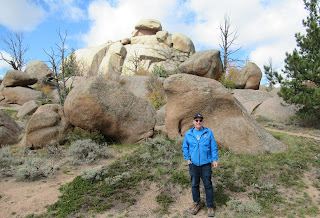
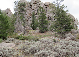
Vedauwoo is famous for its rocky terrain, consisting of boulders, slabs, and cliffs. People come here from all over to rock climb, mountain bike, hike, and camp. It's a land of enormous Sherman granite rocks made of pink feldspar, white quartz, black specks of horneblende, and other minerals including sparkly mica. These ancient rock formations were created by ice, wind, and water and defy gravity up to 500' in the air. You'll see what I mean in the photos. It looks like many of those rocks shouldn't be up there. And, it is the case that rocks could tumble down at any time.
[NOTE: I think I should have been a geologist. Places like Vedauwoo in Wyoming, and Enchanted Rock north of Fredericksburg, Texas, fascinate me. Both geologic wonders started out as giant batholiths.* (*batholith: a large mass of igneous rock that has intruded and melted surrounding strata at great depth. Batholiths usually have a surface area of over 38 miles squared. As is the case with Enchanted Rock, a lot of the batholith is underground.)]
A beautiful national forest campground sits amidst the towering rocks at Vedauwoo. It is first-come, first-served dry camping with vault toilets and a central water spigot. There are a few large RV sites, but most are for small-to-mid-sized units. There is a separate campground for tents only. This campground is easily accessible from I-80.
We drove 40 minutes west from Cheyenne, Wyoming on I-80 to Vedauwoo in Buford, Wyoming. When we arrived at the self-pay station, we had forgotten that this park is in the Medicine Bow-Routt National Forest. If I remembered my National Park Pass we wouldn't have had to pay the $5 fee. Oh, well, we don't mind supporting our national park system.
Our goal today was to hike the Vedauwoo Glen Loop (one mile) and the Turtle Rock Trail (three miles). I took a plethora of photos today. Oh, we had striking fall colors as well!
 |
Photo of rock formations while driving
into Vedauwoo Recreation Area. |
 |
The road is lined with the fall colors
of quaking aspen trees. |
 |
I took a photo of the trail map at
the self-pay booth. |
Today, we parked in the Box Canyon Day Use Area and walked the easy Vedauwoo Glen Loop Trail. The surface of the loop trail is paved, but you can take a short dirt out-and-back side trail to an old bridge and scramble on the rocks if you'd like.
 |
| Box Canyon Day Use Area. |
 |
| Vedauwoo Glen Loop Trail. |
 |
Box Canyon Day Use Area
picnic tables are set amongst
the rocks. |
 |
We didn't see any bears, but
apparently they're around. |
 |
| The Box Canyon. |
 |
Bob is on the paved Vedauwoo Glen
Loop Trail. |
 |
| Pretty colors on the rocks. |
 |
We're on the natural surface
side trail in the box canyon. |
 |
A long, curved rock. At the center
top of the photo is a hoodoo. |
 |
In the box canyon of the Glen Loop
Trail. |
 |
I'm amazed by the way the rocks
on top eroded. |
 |
| A slab on top of boulders. |
 |
| The Glen Loop Trail. |
 |
| A balanced rock. |
 |
| A veritable wonderland of rocks. |
From the Box Canyon Day Use Area we walked the park road to the East Turtle Rock Trailhead. When we were here in June 2020, we walked the trail in a clockwise direction from the West Turtle Rock Trailhead. Today, we're going counter-clockwise.
 |
| East Trailhead. |
There are beaver ponds along the Turtle Rock Trail. Unfortunately, we did not see any beavers, just a lodge. |
There are a few beaver ponds on this
hike. Here's one of the lodges. |
 |
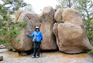
Big boulders are everywhere on
this hike. |
 |
| Boulders everywhere you look. |
 |
| The trail marker. |
 |
| I love my handsome man! |
You can tell by looking at what we're wearing that it's chilly. At this elevation (7,000-8,000') it's much cooler than Cheyenne. We also did some huffing and puffing as the trail is moderate with ups and downs. |
Bob calls this "verticality," an apt
description. We love it! |
When we started hiking, it was sunny and warm in the box canyon. Bob took his coat off and tied it around his waist. I was getting warm, too. However, we knew the forecast was for scattered thunderstorms at 4 pm. It was only 1 pm, so we thought we would be okay.
It's so funny that Alltrails.com has a comment about the Turtle Rock Trail saying he spent all his time looking for the "damn turtle." So did I. If you look at the photo below, I think the big formation in front looks like a frog and the flat slab formation in the back looks like a softshell turtle.
 |
| A frog and a softshell turtle?? |
 |
| A fallen tree with a twist. |
 |
Part of the trail is on the batholith.
It makes a great walking surface. |
 |
| It's easy hiking here. |
 |
The row of boulders in the foreground
is fascinating to me. Was there a column
of rounded rock that fell over? |
 |
Another view of the frog and the
softshell turtle. |
 |
| A natural rock garden. |
 |
| Bob descending this part of the trail. |
 |
| It's such a beautiful day...for now. |
 |
The trail goes through Ponderosa
pine (smells like butterscotch). |
 |
| The trail winds through boulder fields. |
 |
Uh, oh. The sky is looking very
threatening to the west! |
About two-thirds of the way around the loop, we saw dark clouds moving in. It was 1:15 pm. About 20 minutes later the thunder kicked in, followed a few minutes later by rain. |
| The sky was still beautiful to the east. |
 |
Toward the end of the hike, we
entered the fall color zone. |
 |
Even the understory plants got in
on the fall colors. |
 |
| Another beaver pond. |
 |
Look at the way the rocks on top
eroded. Crazy! |
 |
| Looking good, Bob! |
 |
| Did you just sneak into my photo? |
It has now started raining. We heard thunder. Thankfully, we had a steady, light rain, not a downpour. We still got wet, mind you. We picked up the pace to get back to the car, but I couldn't stop taking photos.
 |
It has now started raining. You
can barely see Bob's blue coat
disappearing into the trees. |
 |
| A pretty peachy-orangish tree. |
 |
| The beaver pond is very large. |
 |
| Very tall rock formations. |
 |
| These rocks tower over the trail! |
After two hours of hiking, we went to Mongolian Grill for lunch. That was a great meal after hiking in the cold and rain!Back at the 5th wheel, Bob decided to go for an hour-long bike ride on bike paths around Cheyenne. Scattered thunderstorms were predicted all afternoon and evening.
He had been gone just about an hour when I heard thunder. The rain started and Bob returned shortly thereafter. Good timing on his part, especially because a glorious double rainbow parked itself over the RV park and he got to take photos of it.
 |
| I took a photo from our front door. |
 |
Bob stood in the rain and got a
great shot of Rigamarole under a
rainbow. |
Then, we had a beautiful sunset and a very unusual cloud formation.
 |
The peach colored clouds were a strong
uplift. The dark gray clouds hung
down underneath. |
Wow, another wonderful day of adventure, including a box canyon, boulders, beavers, and bear warnings.
Bye-bye!


