Cliff jumper, South Point, Na'alehu, Big Island - Monday, March 10, 2025

Cliff jumper, South Point, Na'alehu, Big Island - Monday, March 10, 2025

Friday, March 15, 2019

Turquoise Trail, Tucson, Arizona - Part 2, Friday, March 15, 2019

Tucson, Arizona - Continued from Part 1...

I forgot to mention that after walking 10k (6.2 mi.) in my hiking boots, I changed into clean, soft socks and my comfy Skechers. Doing an 11k (6.8 mi.) walk in the same hiking boots would have been pretty rough on my feet.

After lunch, the drive downtown took us about 15 minutes. We started the walk at a hotel near the convention center. Tucson has a long history and today we learned about it. 

In front of the Convention Center is a blue line on the pavement, the "Turquoise Trail." 
Bob taking the "Turquoise Trail"
around the Convention Center.
Following the Turquoise Trail, we immediately came to historical markers explaining the two hills directly west from the Convention Center: "A" Mountain/Sentinel Peak and Tumamoc.


"A" Mountain/Sentinel Peak (left);
Tumamoc (right)
"A Mountain/Sentinel Peak: This basaltic hill has long been a part of Tucson's history. For millenia, native peoples farmed the fertile floodplains near the base of the hill thanks to the natural springs and the flows of the Santa Cruz River that were perennial here. The word 'Tucson' is derived from the Tohono O'odham name for this hill, 'Chuk Shon,'... translated as 'at the black base.' In the late 1700s, the Spanish built a small chapel in the O'odham village at the base of the peak, making this the birthplace of modern Tucson.
"Students at the Univerisity of Arizona celebrated a football victory in 1915 by constructing an 'A' out of local rock and whitewashing it. The painted 'A' became a new cultural icon, and this whitewashing custom continues every fall."
"Tumamoc: The name of this basaltic hill (just north of 'A' Mountain) comes from the Tohono O'odham word for horned lizard, 'Chemamagi.' In 1903, the Carnegie Institution founded the Desert Laboratory on Tumamoc with the goal of understanding the flora of the Sonoran Desert. The site was chosen because of its rich and diversified vegetation and its proximity to the University of Arizona and Tucson, then a town of about 7,500. For over 100 years, the saguaros and other plants have been monitored, making this the longest continuously studied area in the Sonoran Desert. In 1940, the hill became the property of the U.S. Forest Service...The hill, now under the management of the University of Arizona, continues to be used for botanical research. In addition, the hill was used by native peoples for farming and other purposes for several thousand years and is an important archaeological site."
Along with our walk instructions, we received a "Points of Interest Along Historic Walk" narrative. After the Convention Center, we passed the Sosa-Carillo-Fremont house, the Tucson Community Center with its concert hall, little theater, landscaped gardens, and public pavilions, Music Hall Plaza with waterfalls (all were dry while we were there), and unique sculptures. 


"Sphere Field II," by George Ehnat, 1983
I love rocks and gems. In front of the Music Hall is a gorgeous specimen of a man who is my rock. Oh, wait, I got distracted. The rock is Azurite in Drusy Vugs, Malachite, Chrysocholla, Quartz and Iron Oxides from Morenci, Arizona. It weighs 8,424 lbs. Nobody's going to be stealing this baby anytime soon!


La Placita Village is described as a complex of offices, shops, and restaurants and resembles a Mexican marketplace. However, this village is currently under construction. Everything around it is torn up and some of the buildings look like they may be renovated. It is a complete mess there right now and it doesn't look like any shops are open. 

La Placita Village (?).
The history of this place is that after the Gadsden Purchase of 1854, this "Plaza de la Mesilla" was the end of the wagon road joining Tucson to the territorial capital, then at Mesilla, New Mexico.

Footbridges take you across Congress St. and Pennington St. and down into El Presidio Park. Here we saw the "Plaza de las Armas." On August 20, 1775, Lt. Col. Hugo O'Connor of the Royal Spanish Army selected the site for a new frontier presidio and this park is the southern half of that Presidio. We also saw a monument to the Mormon Battalion of 1846, City Hall, Old Pima County Courthouse (currently undergoing renovation), and more sculptures and plaques. 

Old Pima County Courthouse dome.
Old Pima County Courthouse.

Side view of Old Pima County Courthouse.
Our walk detoured off the "Turquoise Trail," into El Presidio Historic District, and past the Tuscon Museum of Art complex. Many lovely homes of different architectural styles are located in "Snob Hollow" ("the neighborhood near downtown"), along with the Presidio Wall Historic Site. 


Mansions of Main Avenue.
Cheney house - California Mission Style with a
pediment reminiscent of Hispano Flemish
architecture.
Steinfeld mansion.

Presidio San Augustin del Tucson: (from a history marker) 
For about 80 years. the adobe walls of the Tucson Presidio protected the residents of the area from attacks by Apache groups, who opposed Spanish and Mexican peoples and their native allies beginning in the 1600s. The Spanish military designated the site in 1775 on the location of a prehistoric native village site. The fort housed 100 soldiers at its height, and 300 civilians lived in the area, with several hundred O'odham and Aravaipa Apache allies in the vicinity.

We did a complete 180, walking from the early history of Tuscon into the heart of downtown Tuscon Business District with its modern library, along Fourth Avenue, and into the University of Arizona.


Tucson Main Public Library.
Colorful murals.
Three new murals for upcoming concerts.
Keys to your heart with the locks
that go with them. 
From Fourth Avenue, we wandered into the West University Historic District. It's fascinating how the University of Arizona ended up in Tucson. The University was founded in 1885. It was given to Tucson to appease the townfolks' anger for having been bypassed as the site for the territorial capital.

The Arizona History Museum pictured below focuses on the coming of the Spaniards in 1539 to the present. Displays include a costume hall, period rooms, life-size copper mine, territorial Arizona patio, and Spanish colonial silver. The ornate stone facade reconstructed around the entrance is from the original St. Augustine Catholic Cathedral. We did not have time to explore this museum. This will be on our to-do list next time we're in town.


The sculpture below is John Campbell Greenway, a Rough Rider, mining engineer, developer of the Ajo Copper Mines and designer of the town of Ajo for Calumet and Arizona Mining Co., Brigadier General, Army Reserve, and Regent, University of Arizona. You may recognize the sculptor, Gutzon Borglum, who designed and built Mount Rushmore.

"John Campbell Greenway,"
by Gutzon Borglum.
The University of Arizona.
In the traffic circle outside the new student union is a memorial to the USS Arizona. The memorial has replicas of the dog tags of the sailors who died in the sinking of the ship.
Memorial to the USS Arizona.
As you continue through the breezeway of the Student Union toward the back of the building, you will come upon a new USS Arizona Mall Memorial in the grassy quad. The brick area in the center of the quad is the location of the ship's bridge. There is a narrow brick outline around the quad that is the exact size of the deck of the ship. In the Student Union Memorial Building is also a Battleship USS Arizona Museum, and one of the two original ship's bells resides in the Student Union bell tower. An interesting plaque on the outside back wall of the Student Union tells the history of how this original bell was obtained. 


We continued on our tour around campus and passed by Old Main, the University's first building, constructed in 1887. It has been completely restored. The sun was in the wrong position to get a good photo, but I was able to take a picture of the fountain in front. The fountain was constructed in 1919 as a memorial to the University of Arizona students that died in World War I. It was dedicated by General John J. Pershing.


The fountain in front of Old Main.
Cactus starting to bloom.
After exiting the University, we headed down Euclid where we passed by the Iron Horse Expansion Historic District. Homes in this neighborhood date from 1875 to 1949. The architectural styles range from Bungalow/Craftsman to Queen Anne.

At this point in the walk, I am getting pretty tired and whiny. It's been a long day. And then, we come upon a completely unexpected sight: the Diamondback Bridge. The creativity of it made me smile. It is an award-winning pedestrian/ bicycle bridge. As you will see, it is designed to look like a diamondback rattlesnake, complete with fangs and rattle. When you get to the end of the bridge you're supposed to hear a rattle sound, but it must be broken because we didn't hear it.


Bob avoiding the "fangs" of the rattler.
Walk inside the snake.
Exit at the rattle.
The Rattlesnake Bridge. Isn't this pretty?
Next, we came to the Broadway Tile Murals. These tiles show ordinary Tucsonans from the 1920s to the 1960s. 


Broadway Tile Murals.
We finished up the walk in downtown as the sun is going down. If you've ever been on a big snow-covered mountain in the evening, you may have seen alpenglow as the sun bathes the mountain in a pinkish-golden hue. There is one skyscraper downtown that looked like it was showing some alpenglow of its own.
Downtown Tucson at sunset.
We made it back to the truck just after sunset and we were exhausted. It felt so good to go back to the 5th wheel and get our shoes off! Relaxation time.

Thank you to the Tucson Volkssport Walking Klub for all the effort you put into creating these walks. We did three excellent Volkswalks in two days and we didn't get lost. Way to go. Now we have to come back in the future and do the rest of your walks.

Travel Bug out.


Thursday, March 14, 2019

Saguaro East National Park Volksmarch - Thursday, March 14, 2019

We had a leisurely morning in the RV before we headed to the Volksmarch check-in spot at 10:30 a.m. After signing in for the walk at a hotel in east Tucson, we drove 7 miles to the Broadway Trailhead at Saguaro East National Park.

Our weather was beautiful: sunny, cool, and breezy. I started out with a windbreaker but took it off within the first two miles.
Rather chilly winds at the start of the walk.
Even Bob had long sleeves, but
that was to protect himself from the sun.
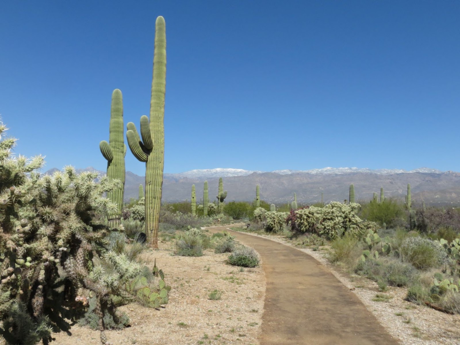
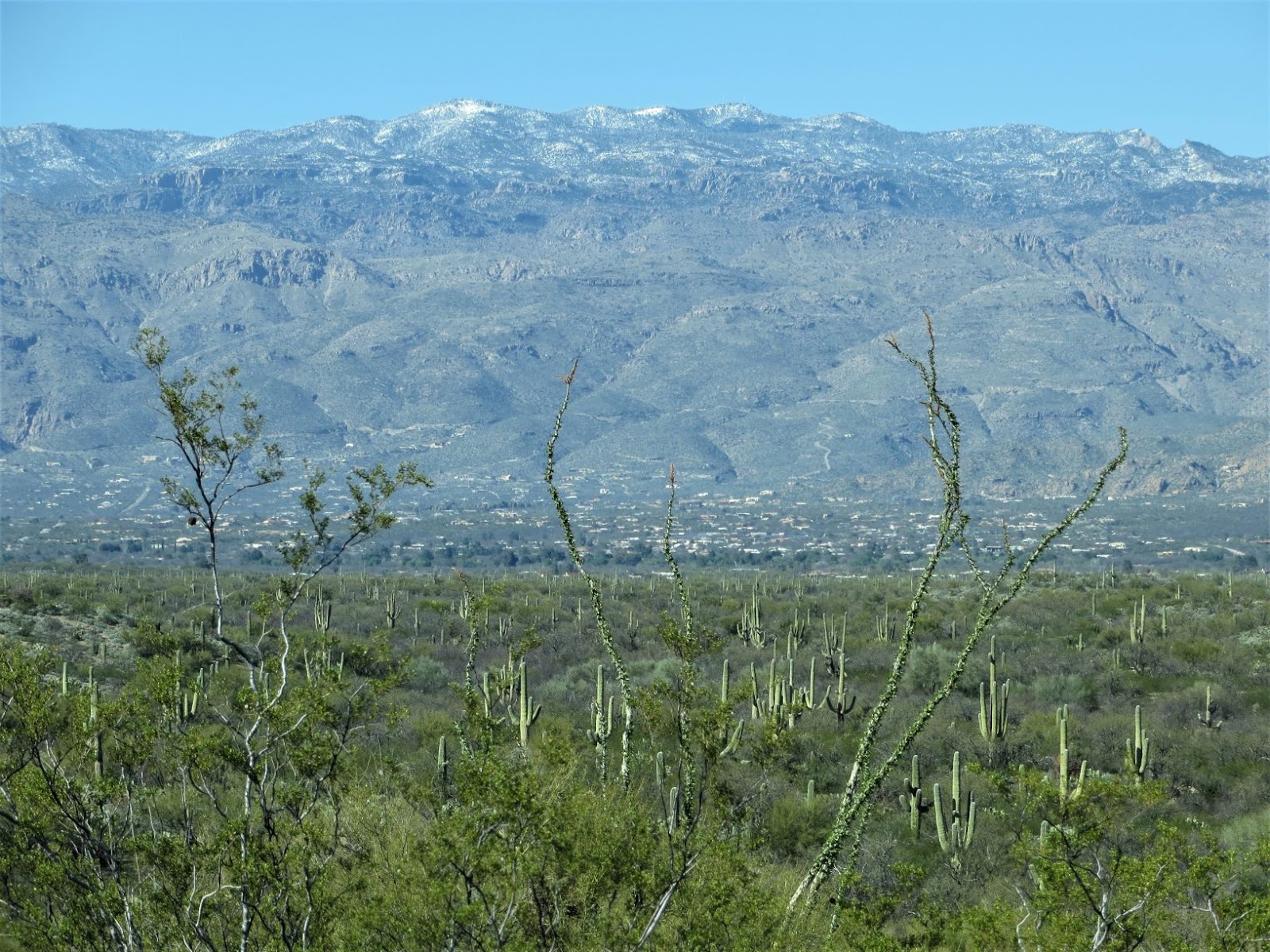
A beautiful vista of desert and
snow-covered mountains.
 In the first mile, we arrived at a small picnic area. A number of people had claimed most of the picnic tables for lunch. We continued on the Broadway Trailhead for a short distance past the picnic area. We then took numerous trails -- with names like Squeeze Pen and Pink Hill -- in a 10k loop around the Broadway Trailhead parking lot. 


Cactus wren surveys all from atop a saguaro.
A crested or cristate saguaro on the left.
Snow-covered Tucson Mountains with radio towers on top.
This is a park dedicated to saguaro (pronounced sa-WAH-ro) cacti and includes Saguaro East Rincon Mountain District and Saguaro West Tucson Mountain District.

Saguaro cacti have a lot in common with trees. For example, seedlings grow best when sheltered by "nurse trees." In a coniferous forest, tiny plants and trees can be found growing on "nurse logs." Saguaros in some places grow together so densely, they're called cactus forests. Birds make homes in saguaros just as birds make homes in other types of trees.

From the national park brochure: 
"Saguaros grow very slowly at first--an inch or so during their first six to eight years. It may be 70 years before they sprout branches or arms. They reach full height, 40-50 feet, at about age 150. The tallest may reach 75 feet. Long, woody ribs support their multi-ton bulk.
"Saguaros collect water through shallow roots extending about as far outward as the main trunk is tall. As saguaros soak up water, accordion-like pleats in the trunk and arms expand to allow for storage in the spongy flesh. Waxy skin reduces moisture loss. Spines shade the plant, shield it from drying winds, and discourage damage from animals.
"Cream-colored flowers appear in early summer. White-winged doves, lesser long-nosed bats, honeybees, and moths feed on nectar and pollinate as they go. In July the deep-red fruit ripens, food for animals and humans. Doves, bats, javelina, and fox are among the animals that eat the fruit, while pack rats and jackrabbits eat the flesh of the cactus.
"Birds find not just food in saguaros, but homes as well. Gila woodpeckers and gilded flickers make nest holes in the trunks and large limbs. Others occupy abandoned holes or build nests in upper branches. Raptors perch on the tallest branches to spot prey."
We did not spot any wildlife today, except a few types of birds and some butterflies. Horses are allowed into the park and the trails show it, many of which had deep ruts from horses' hooves.

Cholla or "jumping" cactus.
A few small wildflowers are blooming.
Well-marked trails, but you need to know
how to read them. We're headed to the
Mica View Trail.
Today's weather and views are spectacular. The mountains in the distance were snow covered from a recent storm. The trails took us up and down small hills, and we crossed two shallow creeks (on strategically placed rocks). Hiking poles helped with stability across the stepping stones.


Mostly little wildflowers in bloom at this time.
These are some very old saguaros.
See Bob? He's 6' tall.
Yellow evening primrose.
Bob is by one of the stream
crossings.
Crystal-clear, long-distance views.
Ocotillo cacti's red blooms are
just starting at the tips of the stalks.
Ferocactus wislizeni (Fishhook barrel cactus)
Cholla cactus (foreground);
saguaro cacti (background)
The typical trail we hiked on today.
Another cristate saguaro.
Saguaro forest.
When we finished our walk, a park ranger was by the side of the road with this burro. Too cute not to take a photo! Next stop: lunch at Safeway deli.

Apparently a national park burro.
Since we were in the area, we drove over to the National Park Visitor Center. 


After watching the slide presentation and looking around the small museum, we decided to do the Cactus Forest Loop Drive. The terrain was very hilly. Bob and I thought the scenery was pretty much the same as on our 10k walk earlier, only the walk was more up close and personal. We did the Desert Ecology Walk (only 1/4 mile) which was pretty lame after all that we had seen earlier.


Gotta love those views!
Cactus Forest Loop Drive.
The one place I wish we had gotten out of the car on the Cactus Forest Loop Drive was Javelina Rock. People were climbing all over it. I love scrambling about on rocks.
Javelina Rock.
Back at the Visitor Center, there is a lovely tile mosaic of the Sonoran Desert. I took a few photos of it, along with the identification key to plants and animals on the mosaic. This is a beautiful work of art.


Tile mosaic (?) of the Sonoran Desert.
Gambel's quail and coatimundi.
Mountain lion and red-tailed hawk.
Western Collared Lizard and Cactus Wren.
Identification key to flora and fauna.
After a long day of hiking and exploring, we made a stop at AT&T to inquire about our new phone and internet plan, and to pick up something we forgot at Walmart yesterday. We then headed back to Bar J RV Park for the night.

Tomorrow, we will do a 10k Volksmarch in Sabino Canyon AND an 11k Volksmarch in downtown Tucson. Until then, Travel Bug out.