
[Note: Continued from Part 1.]
When we exited the casino, we came out at Dr. Martin Luther King Bridge at Laclede's Landing. We have now progressed back in time from the bustling, industrious, garment district downtown of the late 1800s and early 1900s, to the river life of Laclede's Landing
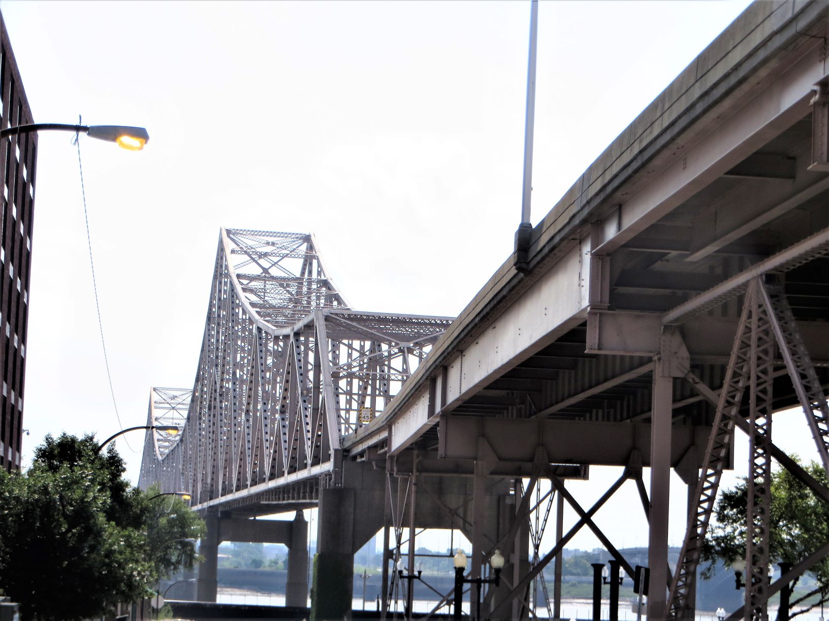 |
| Dr. Martin Luther King Bridge over the Mississippi River. |
 |
| The historic riverfront in Old St. Louis |
Laclede's Landing is the site of St. Louis' birthplace in 1764. Cobblestone streets retain the original grid laid out by the city's founders. In researching St. Louis's early history, five main subjects caught my attention: (This is from Laclede's Landing Riverfront District website. You can read more on their web page if you'd like.)
The Founding of St. Louis (1763-1764: French fur trader Pierre Laclede Liguest found just what he was looking for in 1763 when he discovered present-day Laclede's Landing downriver from the confluence of the Mississippi and Missouri Rivers: the ideal location to establish a trading post. On a bluff that rose above the river, Laclede and his lieutenant Auguste Chouteau spotted a thriving forest and a vast prairie full of streams. They decided to mark the spot to return to after the winter
The following year, in 1764, Chouteau returned to that spot with 30 men as soon as the river thawed enough for safe passage. Together, the men built cabins and a warehouse. When Laclede visited in the spring, he named the settlement "St. Louis" in homage to King Louis IX of France
Clamorgan Alley (1784-1814): At the heart of present-day Laclede's Landing, Clamorgan Alley has a history all its own. Named after the trader, merchant, and financier Jacques Phillippe Clamorgan, a native of the West Indies, the alley has become one of the most famous places in the city to take pictures of the Gateway Arch
 |
| Clamorgan Alley has a great "slot canyon" view of the Gateway Arch [Photo copyright: Susan Alton] |
 |
| A view of the Arch from Clamorgan Alley [Photo copyright: Susan Alton] |
The location of the present-day alley runs where Clamorgan's property, including his home, cabins, and barns, once stood. Throughout the 19th-century, Clamorgan's descendants became instrumental in the expansion of St. Louis
The Corps of Discovery (1804-1806): As the launching and return point of
Lewis and Clark's Louisiana Purchase Expedition, the city played a vital role in the expansion of the United States during the 18th century. Even after the successful completion of the expedition, St. Louis remained dear to William Clark as his home from 1807 until his death in 1838. [NOTE: He also opened a museum here for memorabilia from their adventure west.]
 |
| National park historical marker about Clark's museum |
The Freedom School (1840s to 1850s): In 1847, the Missouri General Assembly passed a law that stated: "No person shall keep or teach any school for the instruction of negroes or mulattoes in reading or writing in this State." The assembly also forbade Black people to hold meetings These laws were in reaction to the several schools and classes for Black children led in church basements under the guise of Sunday school. Missouri's slave owners feared that educated and literate Black people would rebel
Leading the charge in educating St. Louis's Black population through clandestine sessions were the Chambers Street Baptist Church, St. Paul African Methodist Episcopal Church, the Central Baptist Church, and the First African Baptist Church. The First African Baptist Church was established in 1825 by pastor John Berry Meachum, a former slave who bought his freedom as well as his family's
After the law was enacted, Meachum found a loophole by building a steamboat and anchoring it in the Mississippi River, where there was no federal jurisdiction. In the 1840s and 1850s, hundreds of Black children received an education by
attending Meachum's "floating school," thanks to many teachers from the East
The Great Fire (1849): Late in the evening on May 17, 1849, a fire raged on St. Louis's bustling riverfront. The blaze began on the steamboat White Cloud, and the efforts of volunteer firemen were not enough to contain the flames as they quickly spread to several nearby steamers
During the mayhem, the lines of the steamboat Edward Bates were cut in the hope that the burning boat would be taken into the river's current and flame out without spreading. Unfortunately, the strong current carried the Edward Bates downriver, where it crashed into a mass of other steamboats that were docked along the banks
Even then, the disaster was far from over. The wind blew flames onto the levee, where piles of tobacco, fur, and lumber readily burned, fueling the fire along blocks of warehouses. Because the boats were spread out over a mile of shoreline, the river couldn't be accessed as a source of water to put out the flames.
 |
| History marker showing the miles of steamboats along the banks of the Mississippi River. Imagine them all in flames |
Fire captain Thomas Targee sent orders for soldiers to use kegs of gunpowder to blow up the buildings in order to create a fire-stop. His idea worked to an extent, but he was subsequentially killed in one of the explosions
Despite the valiant efforts of nine volunteer firefighting companies, the fire ravaged the city for hours, finally burning out at 7 a.m. the next morning. The carnage numbered three men, 23 steamboats, and almost 15 city blocks
Also, in rebuilding the downtown and the riverfront, the levee was expanded, streets were widened, and brick and cast iron were used in rebuilding the district
Surprisingly, a handful of positives rose out of the ashes and devastation. On May 31, the newly formed Fire Association voted to ask the city of St. Louis for $1,500 annually for each volunteer fire company in order to support their volunteer efforts. It would take almost 15 months before an ordinance was passed to pay
each volunteer company $1,000 to cover its annual expenses
 |
| Laclede's Landing buildings |

There was a lot going on in St. Louis back then! With all that history under our collective belt, let's continue on with the walk. It's time to see the Mississippi River and the Gateway Arch! Let's get this show on the road, er, sidewalk
The Eads Bridge came into sight and it is a beauty. I don't believe I mentioned that when you pick up your walk instructions, you can also snag a "Sights & Historic Highlights" page from the walk box. I'm using some of the factoids in my blog. Thanks, DeAnne and Gordon Brown
Construction on the Eads Bridge started in 1867 and it opened in 1874. The bridge was designed by James Buchanan Eads, a self-taught man with no previous bridge-building experience. The bridge was the first to use steel truss spans (critics said it couldn't be done) and pneumatic caissons were used for the first time in the U.S. to sink piers into the riverbed. Rails were installed on the lower deck, giving access to the railroads coming into St. Louis. This effectively ended the steamboat era on the Mississippi and made St. Louis the rail hub of the nation. Metrolink light rail system now uses the lower deck
 |
| The Eads Bridge over the Mississippi |
 |
| A catfish-themed manhole cover |
The Witte Hardware building was originally a warehouse distribution center for this exclusive hardware wholesale business that operated here from 1849-1975 (73 years!). It recently underwent a $2 million dollar renovation that strove to modernize, yet keep many of the original architectural details. When this building was originally constructed in 1902 of timber, bricks, and cement, it was said to be the strongest building of its kind in St. Louis. With the upgrade, the "ghost sign" was restored
 |
| Witte Hardware Company ghost sign looks like it has been repainted |
 |
| We are in the vicinity of The Arch |

DeAnne and Gordon made sure to incorporate the Border Crossing special program into their downtown walk. In the photo below, DeAnne and I are behind Gordon and Bob as we all walk out onto Eads Bridge

 |
| I am really into arches and the Eads bridge has lots of them |
 |
| The Gateway Arch from Eads Bridge |
 |
| "The Mississippi River "water highway making the delivery of coal possible |
 |
| Another view of the Gateway Arch and downtown St. Louis, Missouri |
 |
| The Missouri side of the border crossing |
 |
| And on the other side of the lamp post is the Illinois side of the border crossing |
 |
| DeAnne, Gordon, and Bob |
 |
| DeAnne, Gordon, and I |
We finally made it to The Jefferson National Expansion Park which houses the Gateway Arch. I kept chomping at the bit to get inside to ride the tram to the top. However, we meandered around the grounds, read the historical markers, and saw the Mississippi River's high-water mark
 |
| A beautifully shaded, wide walkway leading to the Gateway Arch |
 |
| DeAnne, Gordon, and Bob dwarfed by the Gateway Arch |
 |
| It was hard to get this arch contained in a close-up photo! It's huge |
 |
| DeAnne reading the high-water historical marker by the steps |
 |
| A nice breeze flapped the flags by the Mississippi River |
From the river, we headed to The Old Cathedral
 |
| The Old Cathedral |
 |
| Historical marker on The Old Cathedral |
 |
| The Old Cathedral organ loft |
 |
| The Old Cathedral sanctuary |
Next, we made it to the actual entrance to the Gateway Arch and The Museum of Westward Expansion. On the way into the building, we stopped to ask one of the park police about going up in the arch. He said they were all sold out for today and he didn't think anything was available until Thursday. Bummer! Oh, well, as we say in the RV community, we have "plans made in Jell-o." We will have to plan another trip to St. Louis and make reservations in advance to ride the tram to the top
We did go in so Bob and I could watch the 35-minute movie on the building of the arch. Oh my gosh, it was absolutely fascinating. They had to build a VERTICAL railway to hold the huge crane they needed to lift up the parts of the arch. I'm not going to try to explain the engineering here. It would take all day. If you haven't been, go and see the movie. Explore the museum. We will also have to go back to see the museum because we still had half of the walk left to do and we had already been out for four hours! We were hungry and had lunch in the Arch Cafe
We only had the opportunity to see one small part of the museum--the bas relief artwork regarding the building of the arch, as well as the other tallest monuments in the U.S
.


 |
| Eero Saarinen, designer of The Gateway Arch |
Something has happened to my formatting, so I am going to wrap up Part 2 while I'm ahead and finish this blog in Part 3. You will notice that I don't have punctuation at the end of my last sentence of a paragraph, or after captions under the photos. I've already tried to fix this problem multiple times and it's taking me forever. [To be continued in Part 3!]
Lookin forward to Part 3!
ReplyDeleteThanks!
DeleteI am absolutely fascinated with what you have covered in the blog and what you saw on the walk. I am now taking notes of your blog to ensure I hit the highlights. My biggest fear is running into a street pole or tripping off a curb just looking at all the incredible sights. WOW!
ReplyDeleteThank you. Yes, please be careful about not tripping or running into things. Where we parked on the street near the Pear Tree Inn (across from an animal rescue place), Bob tripped over a sawed-off parking meter. It was only about 8 inches high and had a jagged top edge. I'm glad he didn't get cut. Then, we were walking around a building on a corner to get to the hotel and he tripped on a 1" slab of concrete that was sort of the corner entrance into a building. I am so thankful he didn't fall. Where we parked was a great spot, because the parking was free on the street, but beware of trippers if you park in that area.
Delete