Cliff jumper, South Point, Na'alehu, Big Island - Monday, March 10, 2025

Cliff jumper, South Point, Na'alehu, Big Island - Monday, March 10, 2025

Monday, January 7, 2019

It's 75 degrees in the dead of winter - Sunday, Jan. 6, 2019

Today, we're getting our Volksmarch on and doing one of the Texas Coastal Cities special program walks in Port Aransas, Texas. From Ransom Road RV Park in Aransas Pass, we had to drive and take the very short (5 minute), free ferry ride over to Port Aransas, Texas. 

Normally, you can take RVs and big rigs on the ferry; however, not when the tide is out. Luckily, we had our 5th wheel parked, so when we saw the sign that  the tide was out, we were glad we weren't hauling the trailer with us.

On our way to the ferry, we passed a dock where work was being done on three seadrills. These look like the oil platforms used out in the gulf.

Seadrills at the dock, West Sirius.
When we moved up closer to the ferry, we had a good view of wind turbine propellers being off-loaded from a ship. As we got out on the water, we had a better view of a seadrill too.

Propellers stacked on the ship.
Off-loading propeller parts.
Port Aransas Ferry System.
Ship and seadrills. Seadrills are in the water.
As you can see, it's a gorgeous mid-winter day. Sometimes we spot dolphins in the water from the ferry, but not today. Our trip across the water was uneventful. 

Today, we're doing a 10k Port Aransas Beach Volksmarch that starts at a motel. We got a little turned around at the beginning of the walk, because the map on the back of the directions did not match the written instructions. That's okay because I got some great pelican photos.


We apparently were supposed to follow Cotter from the front of the motel directly south to the beach. However, the street did not have a sign on it. The map showed going over to the beach park by the ferry and doing a loop around there. Anyway, we figured it out and stuck to the written directions from then on.

On Cotter St. we found some pretties to look at. 

Me in one of the guppies at a seafood restaurant.
All around Port Aransas, people decorate Farley boats and put them in front of their homes and businesses. I thought the one below was cute. The skipper is a cat with binoculars.

Close-up Skipper Cat in Farley boat.
Below is the Tarpon Inn. It has a long and varied history. 

From the historical marker in front of the inn: 
In 1886, Frank Stephenson, a boat pilot and assistant lighthouse keeper, opened an inn here in an old barracks. He called it "Tarpon Inn" for the abundant trophy fish in the Gulf waters. For a short time Port Aransas was known as "Tarpon."

In 1897, the Cotters bought the two-story inn from Stephenson. When that building burned to the ground in 1900, two new structures were built in 1904. When the 1919 hurricane destroyed the main structure, the dining facility was used until it was sold in 1923 to the Ellis's. They rebuilt the inn to resemble the old barracks. However, James Ellis placed 20-foot poles in 16 feet of concrete with pilings at the corner of each room to reinforce it against future hurricanes.

Franklin D. Roosevelt fished here in 1937. Duncan Hines (of cake mix fame) spent his honeymoon here and recommended the food for the next 25 years.

The hurricane reinforcement put in by James Ellis worked, and in the intervening years the inn has housed many area residents during storms and served as headquarters for the Red Cross, Salvation Army, and military units. 

This is where I'm coming if I'm ever stuck in a hurricane in Port Aransas!

Tarpon Inn.
Love the surfboard at Potter on Cotter.
For Sandcastle Lessons call...
I always like to see what's on storm drains.
As we approached the beach, we read a number of historical markers about an oil storage facility under the dunes being a target for German subs. Cannon emplacements on top of the dunes and watch towers on shore guarded against an attack, and U.S. ships and planes hunted for a sub. I don't know if they found one.


Just past the history markers is the Marine Science Education Center of the University of Texas Marine Science Institute. They have a trail by their building which the Volksmarch club may want to investigate and include in future walk directions. Plus, if the Marine Science Education Center is open when you walk by, it may be worth a stop to see what's there. We did not go in today. They were re-roofing it and it didn't look open.

Roofing the Marine Science Education Center.
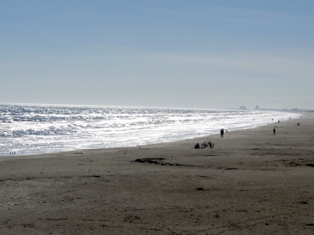
From there, we went around a corner and were greeted by a pond and the Gulf of Mexico. What a glorious day! We wore shorts and T-shirts in the middle of winter and got a tan today. 75 degrees! Score, we came on a good winter day.

Quite a few people out on the jetty.
Still damaged from Hurricane Harvey.
Gulf of Mexico.
Horace Caldwell Pier.
At the pier, our walk instructions said: "Left on the beach with dunes on right and ocean on left. CONTINUE along the beach until you reach Sand Castle Drive. (Fourth beach exit to the right after Caldwell Pier.)"

This is where our biggest walk issue started. To me, fourth beach exit after Caldwell Pier means you don't start counting beach exits until the next one AFTER the pier. And what exactly are "beach exits?" Are they only roads or do they count all the driveways accessing the beach? If we HAD counted the beach access road DIRECTLY ACROSS from the pier instead of AFTER it, we would have been okay.

There was NO sign on Sand Castle Drive. We had only counted three beach exits (we assumed roads) AFTER the pier. We continued to walk another 1/4 mile down the beach but didn't see any more exits as far as we could see. 

We went back to the last road we had seen and turned there. A long block later we saw a road sign for Sand Castle Drive. Suggestion for the directions: Instead of saying fourth beach exit, name the two hotels that are at that beach exit since there is not a road sign. 

Enough rant, back to the beachy part of the walk. It was a Sunday morning and people were building sandcastles on the beach. The grouping below were of churches and they had a bowl out for offerings.


As we walked the beach, we saw a huge tour bus pull up from Pennsylvania. A lot of Amish kids piled off the bus. The girls had on the long dresses and hair caps. The boys had on pants with suspenders and long-sleeved shirts. They were all wide eyed and enjoying the weather and the beach. Many of them made a bee-line for the Port-a-Potties. LOL.

Kite flying was another popular activity.
Another sandcastle.
Close-up of tower.
Port Aransas and points east were hit pretty hard by Hurricane Harvey on August 25, 2017 and the days following. Port Aransas is doing a good job with recovery, but there is still evidence of damage in places: twisted metal sign in front of a business, missing roofs, missing shingles, piles of debris.

Port A Strong...through Harvey, hell, and high water.
Debris pile in Port Aransas, Texas.
 Below, are some very cute beach cart rentals.

Li'l Mater

A Farley boat installation at an intersection. This looks like New England to me.

Farley boat decoration at an intersection.
Bob in the maw of the whale.
"Tarpon" dedicated September 27, 1986.
No artist mentioned that I could see.
We made it back to our start point without further problems. However, we did walk 11k instead of 10. The walk was great. We loved being along the beach. 

Dave and Faye Malouf came over for dinner. They are staying in Port Aransas until February when they depart for points north and east. We had a fun time chatting with them about the East Coast and we will hopefully see them near Bar Harbor, Maine in the late summer when we're on our trip.

Tomorrow, we're off to tour the USS Lexington. Can't wait!

Sunday, January 6, 2019

Indianola, Texas: Camels and Rene Robert Cavelier Sieur de la Salle - Saturday, January 5, 2019

After my big fall in 2012 in Corpus Christi, we have not spent a weekend in the area, except one day with my mom and sister in Corpus six months after my fall, and one day with friends doing a Volksmarch and lunch in January 2014. It is nice to come back for a weekend so we can do more walks.

The weather cooperated. We have a great RV site at Ransom Road RV Park in Aransas Pass, Texas. Even though the sites are close together, the park is clean and neat, has friendly people, and is convenient to everything we need. The price was much more reasonable than a highly popular RV park in Port Aransas. To us, the closeness of the rigs in this park didn't matter. We were out walking and exploring outside the park, and returned to the rig to sleep.

We made camp on Saturday afternoon, January 5. Bob wanted to drive to Point Comfort, Texas, to look at a big job Southwest Electrical Contracting Services is working on. I have to admit, the place is huge. It's called Formosa Plastics and is the second-largest plastic-producing company in the world. How about them (plastic) apples? [My apologies to the movie "Good Will Hunting."]

From the plastics plant, we headed to Indianola to find the history markers Bob knew had to be there. I am clueless about all these history things he knows about, but I go along for the ride.

We drove and drove, but finally got close to where he thought the markers should be. I was feeling doubtful by this point. But, the sunset was spectacular so I was happy to have that to look at.


Indianola, Texas sunset.
Signs, signs, everywhere a sign.
A more unobstructed sunset view.
After Bob indulged my sunset photo shoot, we drove a few hundred feet and, voila, a historical marker about The Great Camel Experiment.* 


"On a New Shore," steel silhouette sculpture
by Brian Norwood of Jal, New Mexico
Once you hear a piece of history you never knew before, you start seeing signs about it everywhere. We first saw the camel signs in Camp Verde, Texas (just outside Kerrville). We also saw the camels exhibit at Fort Davis National Historic Site. Now, here is the U.S. origin of the camel story. [NOTE: On a trip to Louisiana later in January, there was a reference to the camels there as well.]

To sum up this story: besides the human immigrants to Texas from Czechoslovakia, Poland, Germany, Italy, etc., 75 camels were brought in as well. They were imported through Indianola in 1856 and 1857. Talk about a sight that got tongues wagging...can you imagine living along the coast in Texas and all of a sudden camels are traipsing though your town? Wow. People had their memories of that throughout their lives.

Following the end of the Mexican War in 1848, the Treaty of Guadalupe resulted in the United States' purchase of a huge amount of land from New Mexico to California. Before trains or even roads ran through this area, a creative means was suggested for crossing this harsh frontier. It was thought camels could be used for this task, as well as for military purposes.

The Great Camel Experiment was to test camels in the harsh terrain and climate of the Texas Hill Country, south Texas, and west Texas. Around 1848, Secretary of War Jefferson Davis proposed to Congress using pack animals in the desert Southwest. As an officer in the U.S. Army, he realized the military potential of the camel. These camel caravans carried supplies from Camp Verde to San Antonio, Texas (which was the headquarters for the Texas Department of the Army at the time).

After the routine of carrying military supplies back and forth, some of the camels were put onto a new assignment with Lt. Edward F. Beale: survey the "Great Wagon Road" between Arizona and California. Many gold-seeking 49'ers were traveling that way and needed protection from Native Americans and a reliable route. The new, reliable route that Lt. Beale surveyed, later became known as historic Route 66 and includes parts of U.S. Interstate 40.

Camels were also used to help survey routes to the U.S./Mexico border which was some of the harshest terrain they faced on their sojourn in the United States. Lieutenants Hartz and Echols, U.S. Topographical Engineers in charge of the border route survey, both commented on the hardiness of the camels and thought their performance was "all that could be desired" of the animals.

The experiment lasted until about 1861 when the Federal forces were pushed out of Texas at the start of the Civil War. The Confederate troops inherited all U.S. Military assets in Texas, including the camels. With sea trade blockaded at all southern ports except Brownsville, in deep south Texas, the camels were used to haul salt and cotton from the Hill Country of Texas to that port.

After the Civil War, the camels were auctioned off to private enterprises. Camels were used for freighting and were used to haul supplies for the building of the railroad which eventually put them out of business. Some camels were then sold into circuses. It was interesting to learn this great experiment started in Indianola, Texas!

Farther down the waterfront, we also found the historical marker** and sculpture of Rene Robert Cavelier Sieur de la Salle. He was born in Rouen, France in 1643 and traveled to Canada in 1668. He founded a first settlement near Montreal. 

From Montreal, he lead several expeditions on the Great Lakes and the Ohio and Illinois Rivers. He completed the exploration of the Mississippi River in 1682. He returned to France. 

La Salle then sailed from France in July 1684 to establish a colony at the mouth of the Mississippi River. He landed at Matagorda Bay in February 1685. There he established Fort St. Louis. While on his way back to Canada, he was murdered near the Trinity River in March 1687.


Rene Robert Cavelier Sieur de la Salle

Our great exploration is now complete and we can return to the RV park. It was dark when we got back. Bob wanted to watch the Cowboys vs. Seahawks football game and it was time to eat. The RV park recommended Mickey's Bar and Grille two blocks down the street next to the marina.

I'm not a football fan, but the place was comfortable and fun with lots of fans of the Cowboys on hand. I had a side salad and a bowl of their clam chowder. Hands down, that is the best clam chowder I have ever had in my life, even better than places on the Oregon coast. What made it good, in my opinion, was it had huge chunks of clams, perfectly bite-size pieces of potato, not too salty, and a smooth, creamy consistency. Oh, and no gritty sand in it. Bob had fish and chips which was also very good, according to Bob. While Bob watched the game, I read a stack of magazines I had brought. 

What a fun first day of our weekend get-away.

Travel Bug out.

* Historical references about the Great Camel Experiment came from the local historical marker and a research paper by Rhonda Cummins, Coastal and Marine Resource Agent for Calhoun County. In an email with Rhonda, she stated the credit belongs to the Calhoun County historic committee: http://www.calhouncountyhc.org/Camel.html.  

**Information in this blog on Rene Robert Cavelier Sieur de la Salle is paraphrased directly from the base of the sculpture. It was too hard to read in the photo.