[Written on August 27, 2022.]
There's a lot to see and do today. Our destination is Watson Lake, Yukon Territory, Canada.
At the beginning of the day, we again drove through fields of canola and also hay.
 |
| Hayfields. |
One of the stops we're excited about is for excellent cinnamon rolls at Tetsa River Outfitters. Major road construction is happening in that area, so we will have to turn off the road and leave the pilot car when we get to Tetsa River Outfitters.
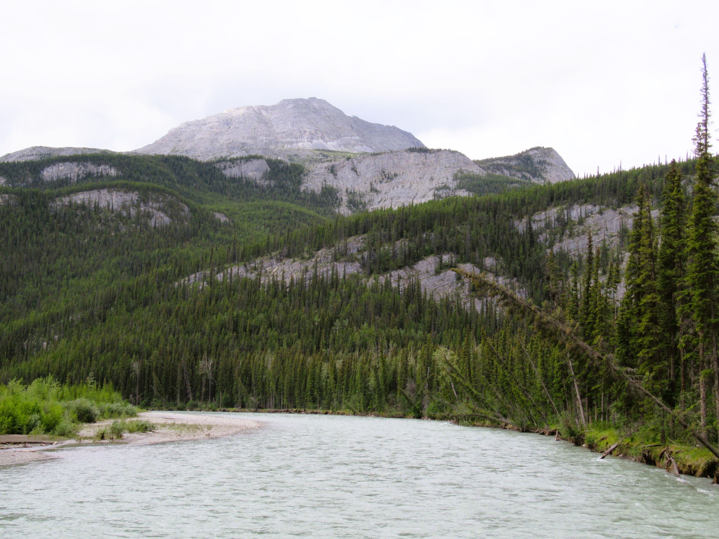
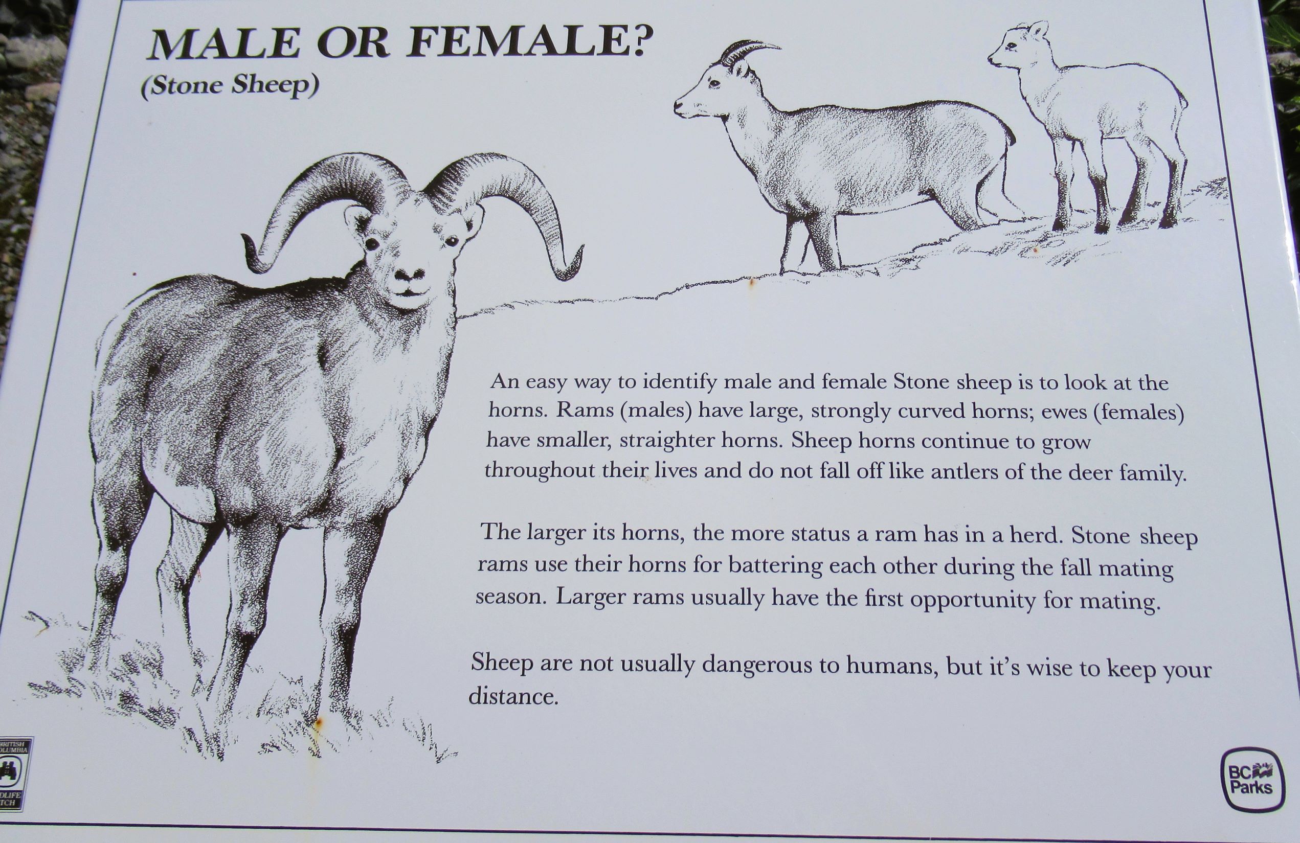
We will drive through Stone Mountain Provincial Park, Muncho Lake Provincial Park, and Liard River Hot Springs Provincial Park as well. During our drive, we're hoping to see Stone Sheep along the road. But we will also watch for moose, bear, and bison!
Our first wildlife sighting was a pair of sandhill cranes. Then, we saw a moose! Bob spotted it on the opposite side of the road. I got my camera out as quick as I could, but the moose was quicker. Bob got a shot of his shoulders and backside. Oh, boy, now we're talking!
 |
| A moose disappearing into the brush. |
The roads were smooth sailing for a while, but then we hit the road construction. Traffic was guided through by a pilot car. It wasn't our turn to go, so we turned off the engine to save fuel. When it was our turn to go, we turned off relatively quickly into Tetsa River Outfitters to buy our cinnamon rolls.
We are now in northern British Columbia and coming up on the provincial parks mentioned above. The scenery is varied and stunning. I'm including a lot of it so you can enjoy it, too.
 |
| View from the bridge above. |
 |
A helicopter flew over this
remote forest. |
 |
Entering Stone Mountain
Provincial Park. |
Stone Mountain Provincial Park has awesome scenery and today was a gorgeous day to see it. You can see how sunny it is.
 |
We wound through dramatic
rocky mountain scenery. |
 |
We were supposed to look for sheep
on the rocks, but we didn't see any. |
 |
A lot of highways in Canada and
Alaska follow rivers. |
 |
A beautiful stand of "trembling"
aspen, as the Canadians call them. |
 |
Look at the vertical geologic
layering in that rock! |
Below are two photos of Folded Mountain. Tectonic deformations have folded the limestone here.
 |
| Close-up of Folded Mountain. |
 |
| Folded Mountain. |
 |
The Trout River flows into Muncho
Lake. |
Muncho Lake Provincial Park showcases Muncho Lake which is 7.5 miles long. The mountains to the west of Muncho Lake are the Terminal Range, mountains on the east side are the Sentinel Ranges.
The lake is known for its jade green water that is caused by copper oxides leaching from underneath the surrounding bedrock. Fish for lake trout, bull trout, Arctic grayling, and whitefish which are native to the area
This is the so-called Serengeti of North America. The area's fauna consists of eight species of ungulates: Stone sheep, mountain goats, bison, moose, elk, caribou, white-tailed and mule deer. Carnivores include wolves, coyotes, foxes, grizzly bears, black bears, lynx, and wolverines.
 |
| Lower Liard River Bridge. |
 |
Liard River as seen from the Lower
Liard River Bridge. |
Liard River Hot Springs Provincial Park is our next point of interest.
 |
One of our black bear sightings
today. |
 |
| Liard River overlook. |
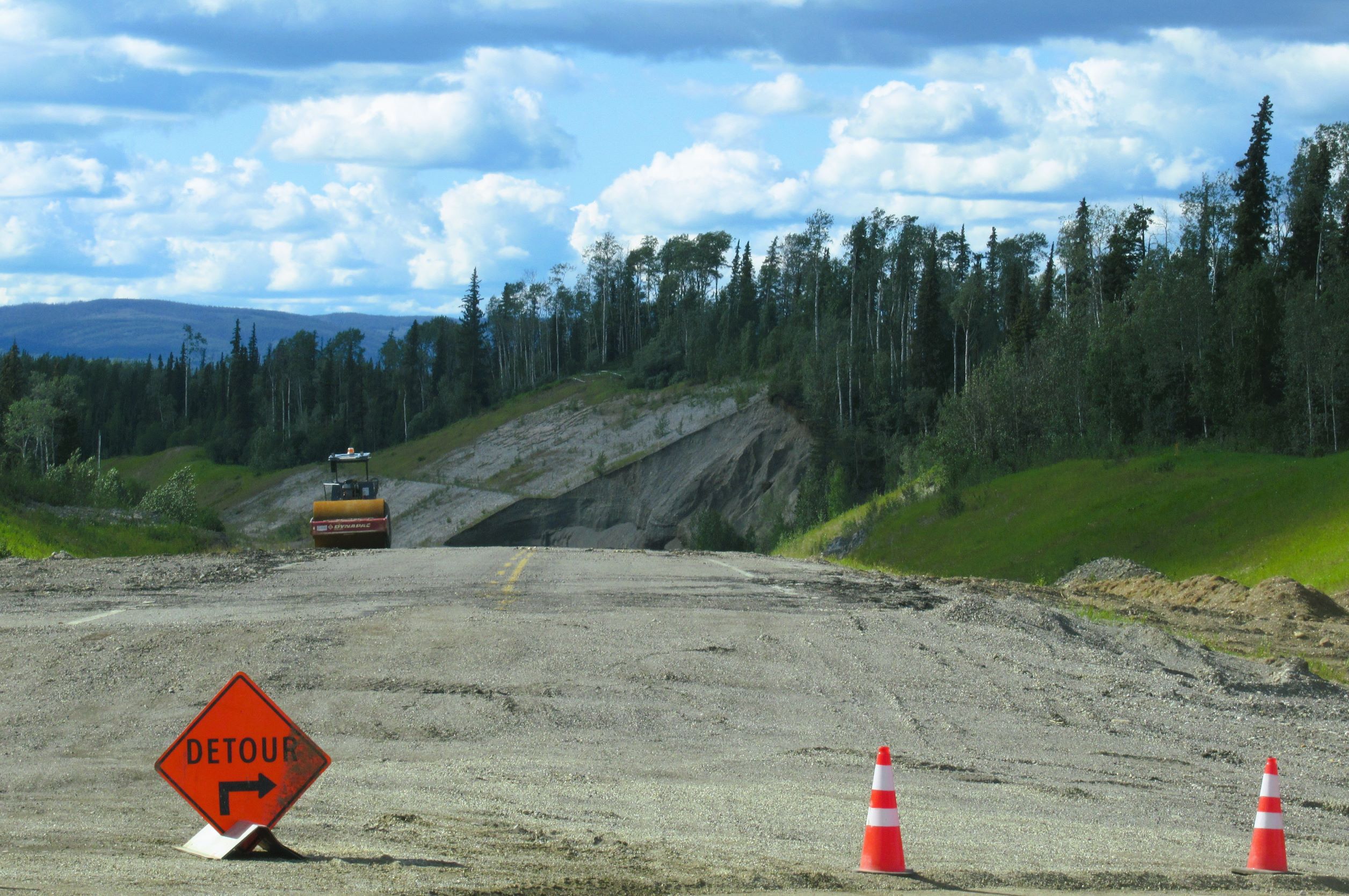
Before we left on our caravan vacation, part of the Alcan Highway washed out in heavy rains. You probably saw it on the news. They thought the Alcan would be closed for months, but they got a bypass open within a few days. Below are the photos of that part of the highway.
 |
| Our detour turn-off. |
 |
From here, you can see the huge
gap where the road used to be. |
 |
| The bypass is dirt with potholes. |
 |
| The bypass. |
 |
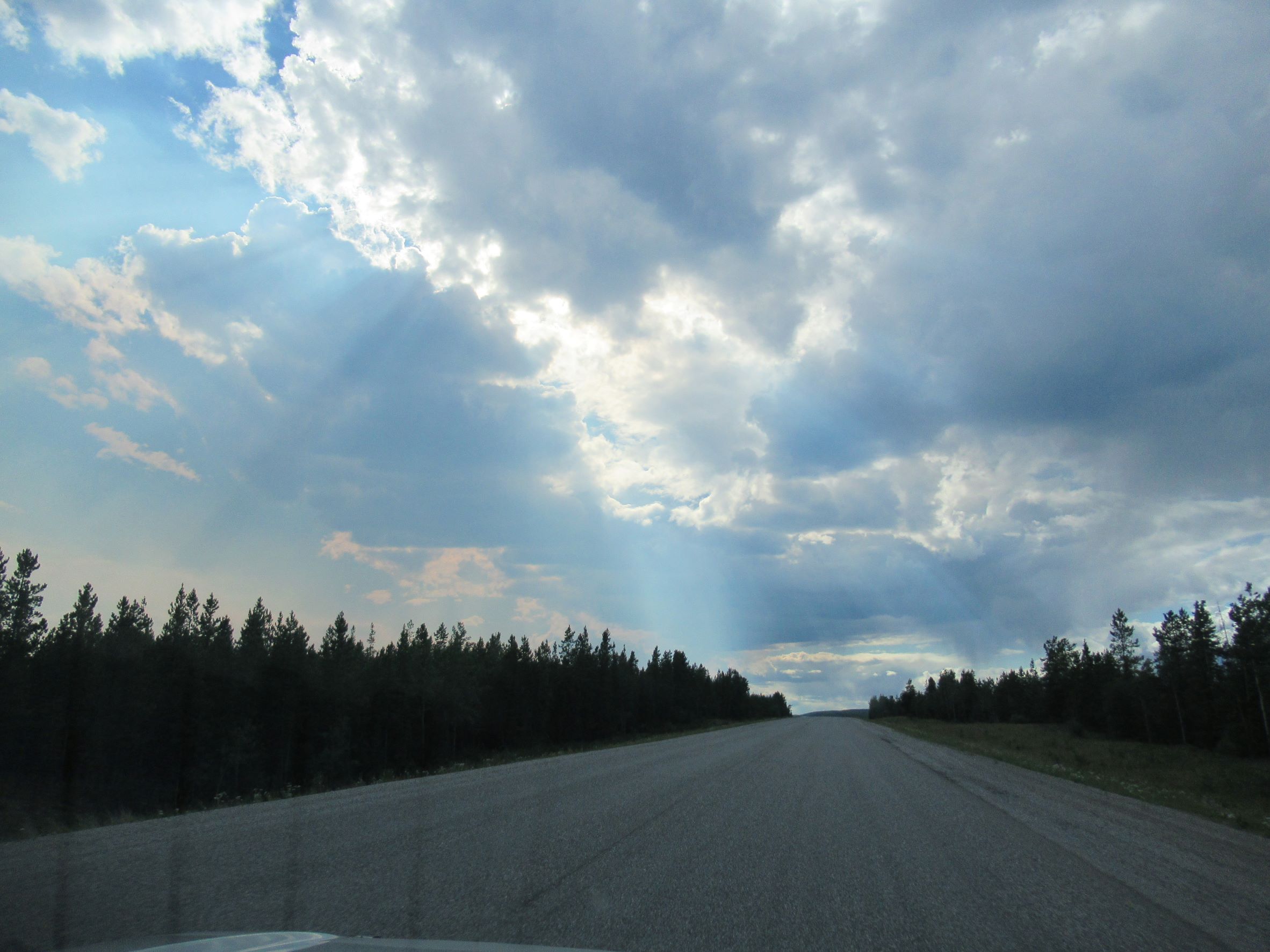
Road construction is done. Now we're
in Yukon Territory. |
We were supposed to camp at Liard River Hot Springs on the way north; however, the mosquitoes were so bad that we will now be stopping on our way back instead.
The sky was very pretty as we drove into Watson Lake, Yukon Territory. We also saw a mother bear and two tiny cubs.
 |
Our 5th wheel is on the end. The
pick-up is parked at the site on the
other side of us. |
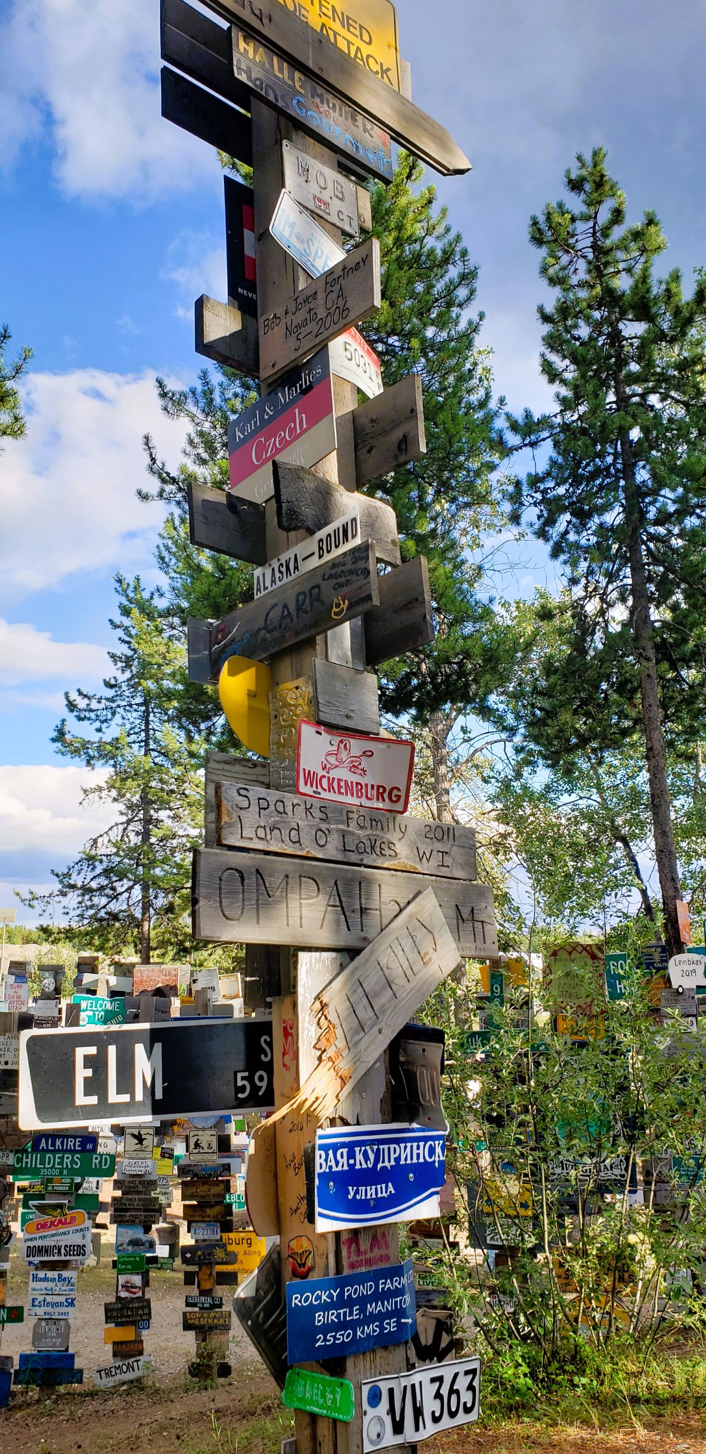
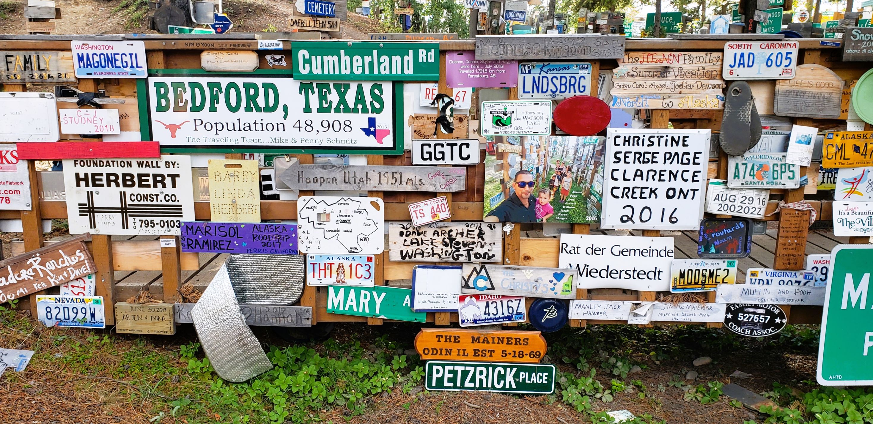
THE thing to see in Watson Lake is the Sign Post Forest. People from all over the world bring their own signs to put on posts. If you want, you can make your own sign at the Visitor Information Centre. We were able to walk to the Sign Post Forest from the RV park. Rain sprinkles fell on us as we explored the maze of signs.
The tradition began in 1942 during the Alaska Highway Project. When U.S. soldier Carl Lindley was in Watson Lake recovering from an injury, a commanding officer asked him to repair and erect directional signposts. As he completed the job, he added a sign with a direction and mileage to his hometown of Danville, Illinois. The trend caught on. At last count, there were about 90,000 signs!
 |
| Bob A., Lynn and Bob Z. |
 |
| Bob and I, and Bob Z. |
 |
| This is a crazy place! |
Bob and I did not walk directly back to the RV park because across the highway from the Sign Post Forest was a big building that said "Northern Lights Centre." That caught our attention so we had to go investigate.
It was 7 pm on a Saturday night and we didn't think it would be open, but it was. What a find. We learned a whole lot about the northern lights. This information will come in handy later in the trip when we may get to see the Aurora Borealis.
 |
| The sign drew us across the street. |
 |
This is how many millions of
miles the sun and planets
are from earth. |
 |
This beautiful mural is on the grounds
of the Northern Lights Centre. |
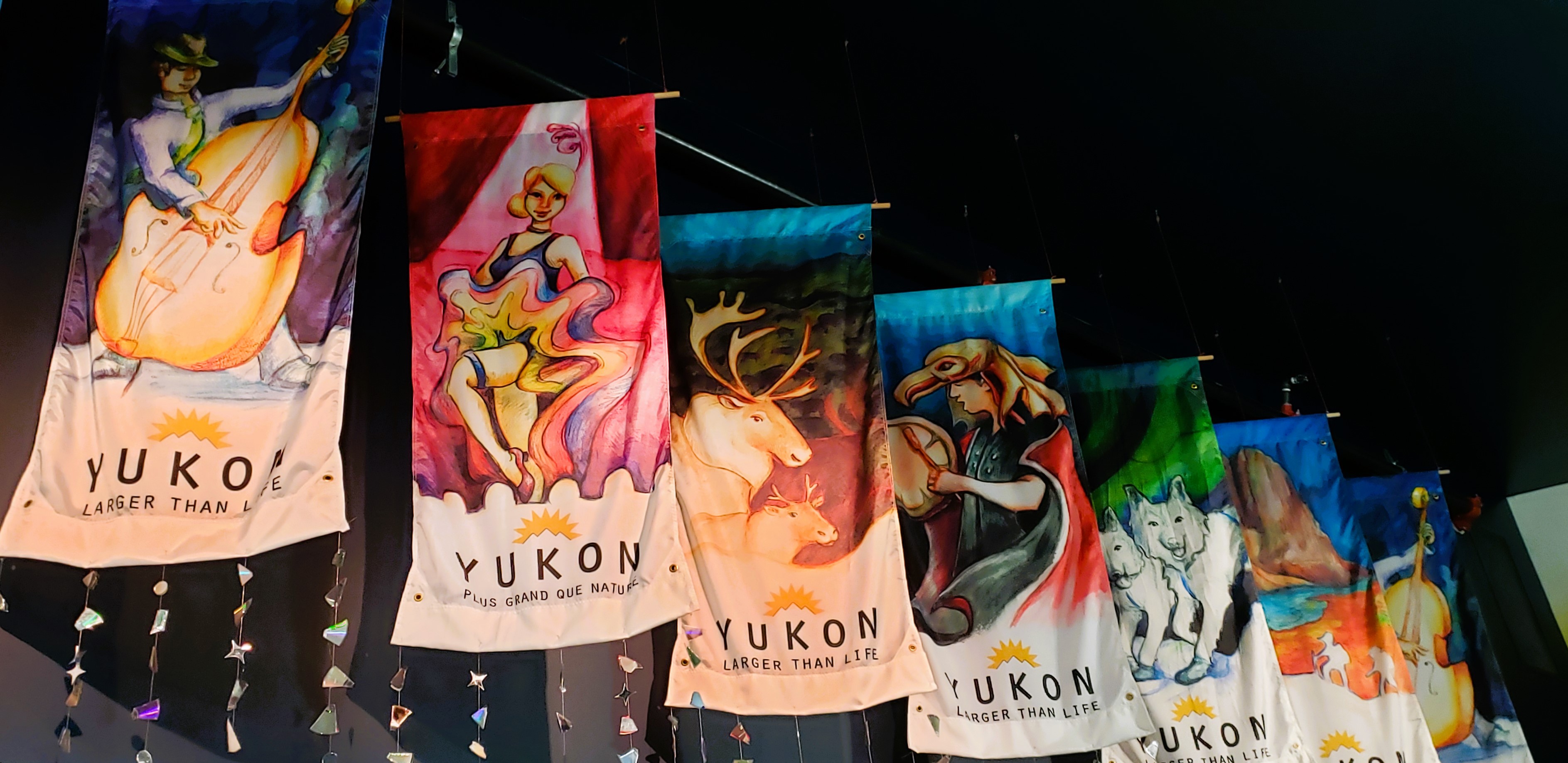
Inside the building is a lot of information on the Aurora borealis. We read all the info on the walls. They had a movie showing the northern lights, but there was a fee for that in addition to the admission. We decided not to do the movie.
 |
| Banners hanging in the vestibule. |
 |
Bob with his photo taken
by northern lights display. |
Let's learn about the Aurora borealis.
When we finished reading the posters about the Northern Lights, it was still light outside. Bob really wanted to see the historic airport in Watson Lake, so we took a drive a few miles to see it. It was located right next to Watson Lake.
 |
| The historic hangar. |
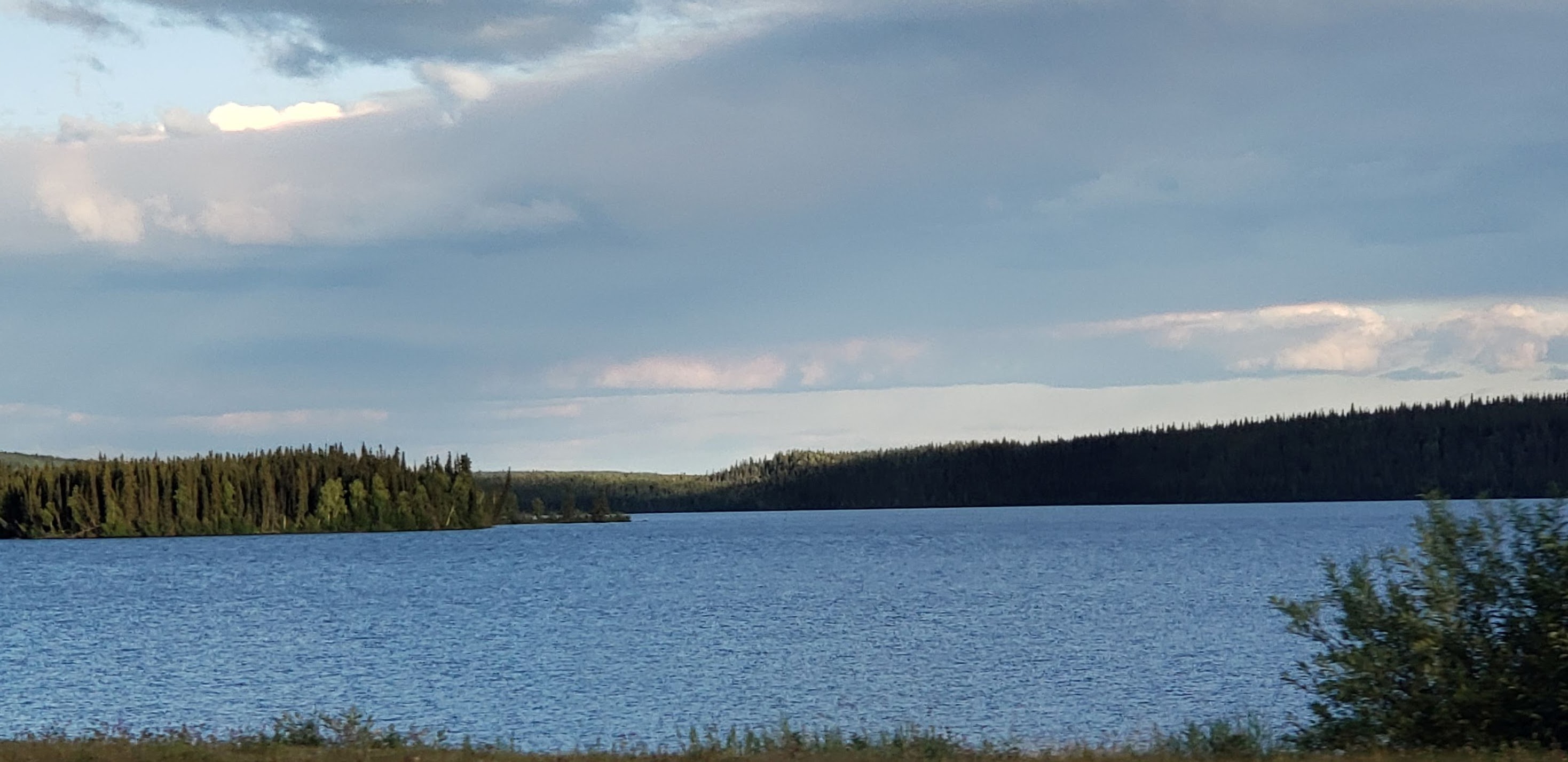
We drove around the grounds, looked at the terminal and control tower, and then drove out to look at the lake.
 |
| The terminal and control tower. |
 |
Watson Lake, Yukon Territory, Canada.
|
 |
| Old mechanical things, or art? |
 |
| Another view of Watson Lake. |
When we returned to the RV park, we walked across the street to see First Wye Lake Park. Bob wanted to show me where he had ridden his bicycle earlier today. There's a boardwalk that goes into a park. He rode to and then through the park. He did not make it all the way around the lake.
 |
We couldn't see the lake from the
boardwalk because of too many tall
cattails. |
Animals we saw today: sandhill cranes, one moose, two black bear and two tiny bear cubs (not in the same place), 40 bison, one ptarmigan, and two grizzly bears!
Finally, the end of this day and this blog. Good night, all.


No comments:
Post a Comment
Please let me know what you think, your experiences, and constructive criticism to make this blog stronger.