Cliff jumper, South Point, Na'alehu, Big Island - Monday, March 10, 2025

Cliff jumper, South Point, Na'alehu, Big Island - Monday, March 10, 2025
Showing posts with label American Volkssport Assoc.. Show all posts

Monday, June 26, 2017

Fairy, Swamp, and Artist, but No Inspiration and No Uncle Tom, Part 1 - Mon., June 12, 2017

In Yellowstone National Park, multiple trails beckon, but whose call do you heed? In our case, we opted to do a round-trip, 14k (8.68 miles) Volksmarch to Fairy Falls. 

Normally, Fairy Falls would be a 10k Volksmarch with a 2k option to Imperial Geyser; however, due to construction to the west of Grand Prismatic Spring for the past couple of years, the walk start point had to be moved north, which makes for a longer walk than in the past.

The weather forecast for Yellowstone today showed cloudy but dry weather for the morning. After noon, however, things looked really dicey with a big storm system moving in.

Our goal for today is the 14k Fairy Falls Volksmarch, and I want to take Susan and Darren to see Grand Canyon of the Yellowstone. So...we were up very early and on the trail by 7:30 a.m. (This is also good in Yellowstone to make sure you secure a parking space before the big crowds arrive.) The trailhead is at the end of Fountain Freight Road.

We are some of the first hikers (a few cars arrived before us). It feels like we're all alone here this morning. Our walk instructions tell us to take the Freight Road almost four miles to our turn-off for Fairy Falls which we do. The road goes south toward Grand Prismatic Spring; however, construction blocks access to the Grand Prismatic Spring area. 
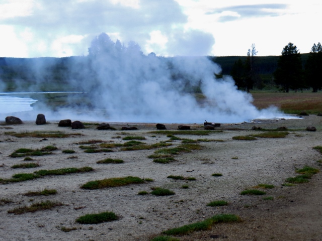

Ojo Caliente hot spring
Firehole River
Ojo Caliente flows into the Firehole River
A field of larkspur blooming

Me on the bridge over the Firehole - Old Freight Rd.

Straight and flat - Old Freight Road
Lake ringed by burned trees

Canadian geese (honkers)
Following the Firehole River

The wildflowers in the photo above and the photo below are unique in that they grow very close to the ground. At first, I thought someone had stepped on one, but in looking around, we found they all looked that way!


As expected, the Freight Road was closed at our turn-off point to Fairy Falls. Bob and I had been to Fairy Falls a couple of times before. The first time we went, there were only two-foot tall trees with no shade; new growth from the massive wildfire of 1988. When Bob and I returned in 2012, the trees had grown to 12-15' tall. Now, the trees along the Fairy Falls Trail are about 25' tall. They are finally providing some much-needed shade on this portion of the trail.

When we hit the shaded, treed portion is also when the mosquitoes descended in droves. Susan, Darren and I were killing mosquitoes on each other's backs. 

Earlier in the hike, we had warmed up nicely and tied our coats and sweaters around our waists. The mosquitoes were so thick, I took my red windbreaker off my waist and slung it around through the air to clear mosquitoes away before I put it back on for protection. (I had left my three cans of bug spray back at the cabin!) A man coming down the trail toward us laughed and said I looked like a matador when I slung my red coat around me. Funny!

So, even, though the day was a balmy 74 degrees, we all put our top layer of warmth back on to keep the mosquitoes away. When we reached the falls, we enjoyed the coolness of the splashing water and how pretty the falls looked. Note: When Bob and I came here both times before it was later in the year and Fairy Falls had only a trickle of water. Today, the falls were lovely.

At 220' tall, Fairy Falls is the park's tallest front-country waterfall. I think "front-country" means it's easily accessible by the masses, as opposed to back-country, which usually means longer hikes and more inaccessible.


Fairy Falls
Susan M. and me
Susan M. and me at base of Fairy Falls
Bottom of the falls is fan-shaped
220' up
Darren and Susan enjoying a bench at the
base of Fairy Falls
I think this is when we broke out the Atomic Fireballs and Jolly Ranchers. We had a little sugar feast. 

Our dilemma became our return trip. We could go back the way we came through mosquito alley **or** brave the lack of bridge across the stream below the falls and the swamps on the alternate return trip. We decided the excitement of the swamp was a better option than fighting off the mosquitoes again.

Between Fairy Falls and Imperial Geyser, I knew there were swampy areas that had wooden planks laid across the worst areas. Beyond Imperial Geyser, I had only seen photos of the mucky swamp. And the mosquito population along this swampy area could be as bad or worse than what we went through. Ah, the unknown.

First, we had to cross the stream at the base of the waterfall. There was a medium-sized, downed log about three feet above the stream. The log had sharp daggers where small limbs had broken off. All the bark was gone so we were dealing with a potentially slippery surface that wasn't very flat. I went first. I used my hiking poles to help with stability.

When I was in the middle of the log over the stream, my foot went down on a very uneven part of the log and I started to lose my balance. Thankfully, I had a class in tai chi at the convention. I stabilized myself, took a deep breath and thought, "Balance, balance." From there on, I was very careful with my foot placement and finished getting across. Susan used her hiking poles too. We all made it across! The old footbridge that used to be there looked like it washed away in a storm at some point.

You may have noticed that the wildflowers are in bloom and I love them! Susan and Darren kept on trucking while I took wildflower photos. They did stay in sight, though. They had bear spray and I didn't, so we didn't want to get too far separated. (Never did see a bear.)


We crossed a number of mucky or wet areas along the trail back. Most wet or muddy areas had planks on the ground. However, at one point when the muck got to be shoe-sucking deep, there were "balance beams" that we had to traverse across a whole meadow. No handrails! See photos below.


The "balance beams" across the meadow.

Ahhh, solid ground
Lots of larkspur


I thought I saw an animal in the distance. When I zoomed in on it, it was a small, dead stump.
Stump animal in wildflowers
Susan photographing Darren
At this point in our hike, we came upon two hot springs that were overflowing. Both covered the trail. What to do? What to do? We assessed the situation. 

On the first spot where we were stymied, I could see the water wasn't very deep and the trail was pretty well indicated. I marched right through it and the ground was nice and firm. The water didn't come over the soles of my hiking boots.

We weren't so lucky with our second encounter. This area was mucky, sucky, slippery mud. Again, the best path seemed to be to follow the trail through the middle of it, keeping in mind that going off-trail around here could mean falling through a thin crust of dirt into a 250-degree hot spring pool. The mud came to the mesh part of our boots, but no higher.

It was getting quite warm by 10:00 a.m. Since it was breezy and the threat of mosquitoes seemed to be in the past, Susan and I wrapped our coats around our heads to protect us from the sun. 

Stylin' on the trail. LOL.
Mileage sign on the right of us in the photo above
We saw this sign after we got back!
Notice that the sign above did not mention bug spray. That was something they should not have omitted! 

Before long, we were back at the van. After a long hike, we like to change our shoes and socks because them dogs are barkin'! What a nice relief.

Once again, Yellowstone blogs take up a lot of space. I am breaking this blog into two parts as well. To be continued in Part 2...


Sunday, October 18, 2015

Sunrise, Sunset, Sunday - Oct. 11, 2015

Sunday morning, day three of our Volksmarch weekend, and we are up with the birds and coyotes. We were given the gate code to enter the state park early. We drove up, put in the code, and drove through. The car behind us made it through too. Our goal: to do as much of our hike as possible before the mountain bike racers came through and to do it in the coolest part of the day.

Driving up to the state park, we had a dramatic sunrise.

Wow!
Down in the canyon, we had to wait for the people manning the checkpoint to get in position. While we waited, we read the sign at the start of the trail stating the trial is 6 miles round-trip, carry one gallon of water per person on a hot day.

We were able to start walking at 8:15 am. The temperature was cool and we were in shade most of the way out on our out-and-back walk. The scenery was spectacular, especially with the sun coming up in the canyon.

Red, layered with white, grey, ochre and light green demonstrated the effects of eons of mostly water erosion. The oldest layers of rock in the canyon, Cloud Chief Gypsum, can't be seen in the Capitol Peak area, but can be seen in a few areas. Here at Capitol Peak, the lower Quartermaster and upper Tecovas formations are exposed. Quartermaster comprises red claystone/sandstone and white layers of gypsum. While above the Quartermaster, the Tecovas Formation is composed of yellow, gray and lavender mudstone and sandstone.

Capitol Peak and a hoodoo on the left
Capitol Peak with the hoodoo on the left

Combination of the Tecovas Formation with the Quartermaster produces triangular Spanish Skirts. See below. Fascinating geology on this walk today.

Spanish Skirts
As we walked the coyotes were yipping and yapping nearby. Meanwhile, my dogs were barking. After walking 12.4 miles yesterday, my blisters felt just like balloons and I spent most of this 6.2 miles limping. Definitely not at the top of my walking game. I was wearing the same hiking boots I wore yesterday, so all my owies were again getting rubbed the wrong way.

On the other hand, the formations drew my attention away from my feet as I gazed in wonder at what was around me. Below is the Lighthouse Formation for which this trail is named.
The Lighthouse in early morning light
Quartermaster Formation: sandstone/claystone with gypsum
Together at last.
We only had three mountain bikes pass us on the way out to the checkpoint. On the return trip, however, the mountain bike race was in full swing. They were flying down the trail. It was actually quite scary to be on the same trail with them. Many spots weren't very wide. Thankfully the bikers were going uphill in some of those areas so they couldn't go very fast. The sides of the trail had cacti with big spikes, so we couldn't step to the side very easily. On the downhills, the bikers were racing hard and flew around the corners. We did our best to stay out of their way.

From the Lighthouse Trail, we had a great view of our nemesis from yesterday, Fortress Cliff. Yes, we hiked from the canyon floor to the top of the cliff, traversed back and forth across the top, before we headed "down." Fortress Cliff showcases sandstone of the Trujillos Formation and the Ogallala Formation tops it off. The Ogallala is composed of sand, silt, clay, and limestone, which compose the hard caprock. [NOTE: The layers from top to bottom are: Cloud Chief Gypsum, Ogallala, Trujillos, Tecovas, Quartermaster, shale.] Fortress Cliff is shown in the photo below.
Fortress Cliff, yesterday's nemesis
When we returned to the truck, the outdoor thermometer read 90 degrees! As soon as we got into the truck, I took off my hiking boots and socks, then changed into clean, dry socks and comfortable walking shoes. We made our way back to Amarillo, hooked up the 5th wheel, and headed out for San Angelo, Texas.

Once again we drove through areas of cotton fields, wind farms and oil rigs. We made a quick stop for a photo of cotton. Thanks, Bob, for snapping this photo.

Cotton on the plant
After six hours of driving, we arrived at San Angelo State Park. Our water/electric pull-through site was $20. It was also time for us to renew our annual Texas State Park pass, so we paid $70 for that as well.

After we unhooked the Beast and set up Rigamarole, our day ended with this beautiful sunset.

Tomorrow...searching for Monarch butterflies at San Angelo State Park. 


Tuesday, September 15, 2015

Tree City - Uvalde, Texas - Mon., Sep. 14, 2015

Our South Texas weather has moderated just enough to let us start our walks at 9 am instead of 7 am. What a relief!

Monday I picked up Susan at her house for a 1-1/2 hour drive to Uvalde, Texas. I wanted to do a Volksmarch that I hadn't been on yet. Susan had only been on the Uvalde walk once and it was a bit different than the current one.

On our drive to Uvalde, we drove past fields of cotton which looked ripe for picking. Other fields held mystery crops which looked suspiciously like weeds, but they were planted in some semblance of order. Identifying signs would have been nice!

You might enjoy learning history and interesting facts about the town. Uvalde is considered the southern limit of the Texas Hill Country and the northernmost limit of South Texas. Historically, this is the Honey Capital of the World for production of huajillo honey, a mild, light-colored honey dating back to the 1870s. Also, Uvalde is known as one of the best locations for soaring in the United States. It was the site of the 1991 and 2012 World Gliding Championships.

Uvalde was the home of John Nance "Cactus Jack" Garner, former Speaker of the House and Vice President. (Bragging rights if you know which President he served under! Susan and I didn't have a clue.) Other famous Uvaldeans born in the city include: Matthew McConaughey, Dale Evans, and former Governor of Texas Dolph Briscoe.

According to the Koppen Climate Classification system, Uvalde has a humid subtropical climate. Thankfully it wasn't humid today!

The start point for our walk was in a Minit Mart. We signed in, used the restroom in the attached laundromat, then started our walk, following the directions provided. I wasn't paying much attention because I was putting on suntan lotion.
After we had gone 3-1/2 blocks, Susan looked at the map on the back of the directions. It was evident we had missed our first turn which was an unmarked alley behind the Minit Mart.

All was not lost, we could cut across the street nearest to us and connect with the route in three blocks. So that's what we did. It's pretty daunting when you get lost on the very first direction. We were happy there was a legible, large enough map on the back of the written directions so we could see how to correct our mistake.

We happily followed the route through sun and shade. We walked down an alley in the midst of an Episcopal school campus. Along the alley was a meditation maze, they call it "Sacred Path."
At the Episcopal school
Sacred Path (meditation maze)
Next, our directions informed us we would go past Uvalde Drugs "which has a soda fountain open until 3:00." Our mouths were watering for a refreshing ice cream soda. Upon arrival at the drug store, we found it closed with a "For Sale" sign in the window. Closed as in nothing inside, deserted, abandoned, empty. Boo hoo for us. We soldiered on.

In the display case at the former movie theater was a poster of King Kong atop the Uvalde water tower with a crop duster plane dusting him, and with a tractor in his hand instead of a woman. Kind of cute. You be the judge.


Down the street we came to the Janey Slaughter Briscoe Grand Opera House. According to our information sheet the Grand Opera House has "plaques of famous Uvaldeans (including a recent Oscar winner)." [I'm guessing Matthew McConaughey]. We didn't see even one plaque. Don't know where they might have been hiding. The actual Opera Theater is on the 2nd floor.
Grand Opera House
Detail on the Grand Opera House
Grand Opera House
We passed through a park in front of the county courthouse.

Park across from courthouse. (This photo looks from
the courthouse toward an antique store.)

The Texas Historic Landmark plaque reveals the Uvalde County Courthouse is the fifth for Uvalde County, which was created in 1856. The current structure, completed in 1928 replaced the 1890 courthouse. The Neo-Classical style's outstanding features include its cast stone segmental arches and ionic porticoes at the entrances.

Cast stone segmental arches and ionic porticoes.


Uvalde County Courthouse

A historic plaque on the front lawn of the courthouse at the intersection of two streets, tells about Fort Inge and Camp Dix, Confederate States of America (C.S.A.).


The sign reads...
A major road west from San Antonio forked in the area of these forts. One road went toward El Paso, the other to the Rio Grande at Eagle Pass. Travelers heading west put on their guns in this region, the start of hostile Indian country, troops from these posts guarded against Indian raids, bandits from Mexico, and marauders. Fort Inge, 4.5 mi. southeast, was on Cotton Road to Eagle Pass over which hundreds of wagons, oxcarts took cotton to Mexico in exchange for vital goods. Part defense line from Brownsville to El Paso. Occupied by volunteer cavalry.
After walking a few blocks on Nopal Street, we took the walking path under Main St. along the Leona River into Uvalde Memorial Park.


History of Uvalde; double click to read if you're interested.

There was supposedly a war memorial but we did not see it. [NOTE: OMG. In looking back at my photos, the sign below is the war memorial. This tells us the whole park is a war memorial. You have to read it all the way to the bottom for that info.]

I hadn't read all the way to the bottom.

For the second time, we got lost using the directions. After much discussion between Susan and I, we retraced our steps back to a four-way intersection in the trail. There was no mention of it in the directions. We were supposed to turn right there. Once we turned right, we found our way again and didn't have any other problems for the rest of the walk. There is a nice disc golf course in Memorial Park.


Trail along Leona River in Memorial Park
Sunning turtles
The turtles above may be red-eared sliders, but they're so filthy it's hard to tell! In addition to turtles, we saw deer, ducks, mockingbirds, and geese.

On Getty Street, one of the main thoroughfares through town, we saw beautiful homes. Then we modified the directions a little to take High Street to where we needed to go (rather than retracing our route on Getty). We did that because High St. had a lot of shade and we were getting hot in the sun. Quite a few different architectural styles.

Love the porch and wrap-around balcony!

Huge tree in front yard of a home


Below is the former home of Vice President John Nance Garner. It is now the Briscoe-Garner Museum. The museum is only open Tuesday through Saturday and we were here on Monday. Susan and I agreed, even if it was open we wouldn't have gone in. We were hot and tired, in need of food. 

Now the Briscoe-Garner Museum
Beautiful southern-style home
A unique attraction on this walk is the Pioneer Cemetery and King Fisher historical marker. This is one of the more interesting historical markers I've read.

King Fisher - quite a guy
An old headstone in Pioneer Cemetery, Uvalde
Tree City saves its trees
Cute sign outside a bakery (Bakery closed Monday)
Another big tree in the road
Passion flower vine and blooms in Uvalde (subtropical).
This kind of plant grew in our Hawaiian backyard!
We stopped to eat lunch at Church's Chicken fast food. They didn't have grilled chicken, so I had cole slaw and mashed potato sides. Susan ordered their chicken tenders and shared some with me. They were not heavily deep fried, just a light coating of flour on them. I thought they were pretty tasty.

At the end of the walk, we had a long drive home. It was an interesting walk in some regards, but I doubt if we'll be doing this walk again anytime soon.

Travel Bug out.