Cliff jumper, South Point, Na'alehu, Big Island - Monday, March 10, 2025

Cliff jumper, South Point, Na'alehu, Big Island - Monday, March 10, 2025
Showing posts with label St. Lawrence River. Show all posts

Monday, July 29, 2019

A Walk Across the St. Lawrence Seaway - Monday, July 29, 2019

In the past week, a number of driving trips back and forth across the 1000 Islands Bridge over the St. Lawrence Seaway to our campsite at Wellesley Island State Park convinced us we needed to walk the bridge over the river. At 11:30 a.m. today, we parked at the North Country Welcome Center on the south side of the bridge. 

North Country Welcome Center

A quick stop in the Welcome Center and we knew it would be a one-half mile walk to the middle of the bridge and one mile, one way if we continued to the end of the bridge on Wellesley Island. It was easy to walk from our parking spot to the entrance of the bridge. 

Thousand Islands Bridge over the
St. Lawrence River
The government entity responsible for
inspecting and maintaining the bridge.
We have now entered the designated pedestrian/bike pathway over the bridge. The driving portion of the bridge is only one narrow lane in each direction with no room for pedestrians or bikes. This is the bridge we took our 5th wheel on to go to Wellesley Island State Park. This is I-81, the main highway to Canada from Watertown, NY. All the semis use this bridge as well.  

Pedestrian/bike path on the bridge.
Even though this looks steep, the climb is actually gradual. I didn't get out of breath at all. The views from the bridge are awesome.

Getting closer to the top.
The St. Lawrence Seaway...no salties or lakies
today. (Hint: Those are the types of ships,
saltwater or freshwater.)
Wow! Looking up at the top.
Checking the east for ships. 
Two jet skis below us.
As we looked down we saw some of the houses along the river near the base of the bridge. Does anyone else see a "face" on the tan house to the left of the blue-roofed house? The windows look like two eyes and a mouth.

Do you see the face on the tan house?
Jet ski on the river.
Looking west we saw pleasure boats, a lighthouse,
and some islands.
Bob at the top of the pedestrian path.
I made it too.
A nice yacht below us.
Zooming in farther west to see more islands.
When we were at the top of the pedestrian path, three guys climbed up from under the bridge. It must have been their lunchtime. I asked them if they work up there every day and they said they do. Their job entails scraping off old paint, putting on new paint, and checking for loose bolts. They help keep the bridge in good shape so it will last a long time. What a view they have from up there. They said they know most of the ships that come through back and forth and they wave at them.

We returned back to the car and went grocery shopping. Then we called it a day and headed back to our 5th wheel. 

Oh, except Bob went out again to fuel up the pick-up truck for our travel day tomorrow. He also walked up the bridge again to watch the sunset. He didn't see any big ships and he said the sunset wasn't all that great so I didn't miss anything by staying in the rig.

Tomorrow, we will have a long travel day to Lake Placid, New York. We will travel along the St. Lawrence Seaway and stop at Massena to see if any ships are going through the locks.

Travel bug out.


Sunday, July 28, 2019

Cape Vincent Lighthouse Volksmarch - Sunday, July 28, 2019

Other Volksmarchers have reported favorably about the Cape Vincent Lighthouse walk. Today we drove from 1000 Islands Campground in Clayton to the small town of Cape Vincent, New York. Even though it's the weekend, we found on-street parking and lightly traveled streets.

We had already checked in via the OLSB (On-line Start Box at my.ava.org) and printed out our directions. It was easy to hop out of the car and start walking. The town is very cute and has a few homes and buildings that stand out architecturally. It was originally settled by the French.

The first unique building we passed was the Cape Vincent Fisheries Station. It is home to the Research Vessel (RV) Seth Green and an aquarium that highlights local fishes. I would have gone to the aquarium, but it is closed due to flooding.

Cape Vincent Fisheries Station (with Aquarium)
I liked the weird arch at the top and
the lintels over the windows.
Sackett house with sunken garden.
1870 - Erastus Burnham house. He owned a
thriving seed and lumber business.
In the photo below you can see the water washing over the dock and the blue police "do not cross" barricade. The locals say the water has come down a little from its high point.

Normally this is the public dock.
Speaking of flooding, if you aren't aware, all the Great Lakes are flooded due to the immense amounts of rain this spring. It is especially evident all around Lake Ontario and along the St. Lawrence Seaway. Docks are closed because they are covered in water. Some businesses built a taller dock on top of the dock that they had so they could get to their boats. [NOTE: We experienced that when we went on the boat tour to Boldt Castle. (That blog is yet to be written.)]

A mural welcoming travelers from Canada to
the U.S. at the Cape Vincent Ferry Terminal.
After walking a few blocks in town, we stopped to check out the Cape Vincent Historical Museum. Below is a Friendship Quilt. It helped raise money for St. John's Episcopal Church. People paid ten cents to have their name embroidered on the quilt. The quilt was then stitched together by the women of St. John's Guild at the rectory. It is recorded that this quilt made somewhere between $72.70 or $74.90 for the church between 1925 and 1928 (which was a tidy sum back then).
A Friendship fundraiser quilt.
The stove below was made in the Forsythe Foundry which was located in this building in the 1800s.

Stove made by the Forsythe Foundry in Cape
Vincent, New York in the 1800s.

The efficient Petit Godin Stove.
Description of Petit Godin Stove above.
Wooden shoes.
We then walked (thankfully not in wooden shoes) two miles to the lighthouse. We loved the view of the St. Lawrence Seaway and the beautiful homes lining the road. There was also a cool breeze coming off the water. 

And, we got caught in a downpour. The rain was driving sideways and it was impossible to keep the umbrella up. We took shelter on the down-wind side of a huge tree trunk. That worked to keep most of the rain off for the short duration of the cloudburst.

A piece of history we did not know: Napoleon Bonaparte had a refuge built for him in this town. The Cup and Saucer House was built by Count Pierre Francois Real in Cape Vincent. Of course, Napoleon never made it. The house burned in 1867.

The Stone House - built in 1815 by
J. D. le Ray du Chaumont to shelter Canadian
rebels during the Patriot War in 1838.
Maple Grove, established 1838.
These mansions all have views of
the St. Lawrence Seaway.
A pretty lighthouse gate in front of a home.
Entrance to Tibbetts Point Lighthouse. It seems
Tibbetts and Tibbits spellings are both correct.
Bob watching his ship come in.
On the lighthouse grounds are a Visitor Center, keeper's home, Fog Horn Building, and an International Hostel. 

Info about the Fog Horn Building.
Tibbetts Point Lighthouse.
Lake Ontario.
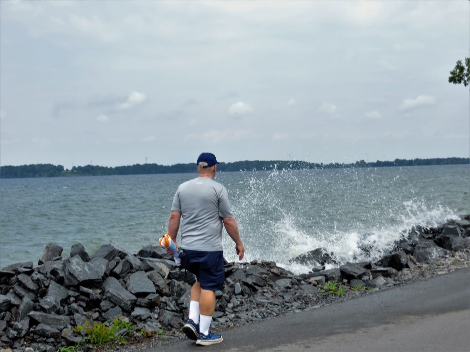
Bob walking along the St. Lawrence River.
You can see how high the river is splashing.
Canadian Steamship Line heading downriver.
Small car ferry heading from
Canada to Cape Vincent.
I zoomed in on the car ferry and the ship.
When we returned to town, the finish of our walk was through more city streets. There were a few cool things to see...
Patriotic birdhouse condo.
Below is an idea that has some merit, although it would have to be closely monitored for expiration dates, bulging cans, broken glass, ants, etc. It is a Food Bank "lending library" (for lack of a better term). It is sponsored by a church.


After the walk, we had lunch at Cape Vincent Brewing Company. It was popular but was just okay in our opinion. They did have funny signs on the wall. 


On the way out of town, we drove a different way and found a previous lighthouse which had been moved to this location to welcome people to Cape Vincent. This lighthouse stood on the Cape Vincent Breakwater from 1900 to 1951.

The previous lighthouse.
We called it a day and headed to the 5th wheel.

Many thanks to the Niagara Frontier Volkssport Club for this wonderful walk.