The Black Hills are so beautiful it's easy to try to see everything in one day. But if you did that, you'd miss out on so much! Today, we packed in five different activities. We had plenty of time for each one, and it didn't get dark on us. We have four more days to hike and do the other activities we planned.- The Custer Skywalk Nature Trail,
- A walk around downtown Custer, South Dakota,
- Sylvan Lake,
- Needles Highway, and
- Custer State Park Wildlife Loop.
We were able to pack so much into one day because we stayed at Fort Welikit Family Campground, one mile north of Custer City (which is the area where we wanted to spend most of our time while we're here).
Custer Skywalk Nature Trail: Bob and I were exploring the area around the Chamber of Commerce/Visitor Center one block off of the main drag (Hwy 16) in Custer. The painted animals you'll find in Custer are bison and the Visitor Center has one in front of the entrance. In addition, someone put sunglasses on the General Custer sculpture there. It made the sculpture look like a cool dude.
 |
General Custer.
|
The Visitor Center was closed, so we walked to the park across the street. Bob was interested in the George S. Mickelson Trail (rails to trails path). There is a user fee of $15 for an annual pass or $4 per day. Bob bought the annual pass since he planned to ride a lot.
 |
Bob buying Rails to Trails pass.
|
While we were looking at the bike trail information, we noticed a trail going up the hill a few feet away. It said "Custer Skywalk Nature Trail." We're always up for a good hike, especially since this one has the reward of an observation deck at the top.
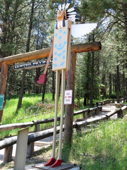
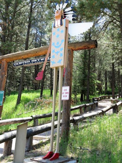
There was contemporary artwork of General George Custer and Chief Sitting Bull at the entrance to the trail.
 |
Chief Sitting Bull.
|
 |
| General Custer. |
At the start of the walk is a sign explaining the trail system, how many stairs to expect, the history of the park, and what we would see from the observation deck. Oh, boy! We were like kids in a candy store. We had been cooped up in the truck driving three very long days from San Antonio to Custer, South Dakota. It was time to stretch our legs.
 |
Custer Skywalk Nature Trail start point.
|
 |
We did the Skywalk Trail.
|
 |
Our start point is on the far right
where it says, "You are here."
|
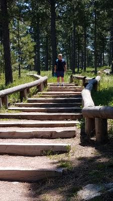
The sign said there are a lot of steps (245 by their count, which I will happily go by because I don't want to count them!). Okay, getting started up the hill was tough. I admit I have been a couch potato at home for the past few months. after huffing and puffing and whining a little, I got caught up in the natural beauty of the place. Undaunted, we kept going up. Verdant forests of ponderosa pine with ancient, jagged rock formations kept us interested in continuing up the hill.
Well, then, going down should be much easier than coming up, right?
It was a whole lot faster!
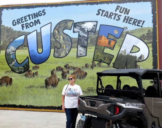
A walk around downtown Custer, South Dakota: After the Custer Skywalk Nature Trail, we walked through downtown Custer, bought some postcards, and looked at the sights. The bakery has a clever sign and logo.
 |
| "You'll love our buns." |
 |
A great souvenir photo in front
of the Custer mural.
|
 |
An art store called "The Peanut Gallery"
has Mona Lisa eating peanuts. |
 |
The art gallery building
is a work of art in itself!
|
 |
Pizza Works is where
we had pizza last night.
|
 |
I sense a theme here.
|
 |
We'll be off to Crazy Horse tomorrow.
|
 |
The Custer sign on top of the hill is lit
up at night with bright white lights.
|
Sylvan Lake: When we were in the Black Hills in 2012, we fell in love with Sylvan Lake. Today, we went back since it was six miles from our campground. It was pretty crowded. Of course, the day was quite warm and what better place to cool off than a lake?
There are now signs that if you are caught jumping off the rocks into the lake, you will receive a $100 fine. The sign did not deter people from jumping off the rocks. Bob was tempted. He loves jumping off of rocks into the water, but he hasn't done it here.
Instead, we did the one-mile loop hike around the lake. This lake was formed by a dam. Still, it is lovely. Once we got past the picnicking and swimming areas, we lost most of the crowds and had a great hike. Some scrambling over rocks was required.
 |
A very flat section of the trail.
|
 |
Kayakers, swimmers, fisherpeople,
picnickers, and hikers were out in force today!
|
 |
A very cool tunnel through
the rock by the dam. |
 |
Views are great on this hike.
|
 |
Wild iris.
|
 |
Outstanding rock formations.
|
 |
I found this handsome guy on the trail!
|
 |
This trail is easy to follow.
|
 |
A sentimental memorial bench.
I love the quote!
|
 |
Wow!
|
And, since we were in the neighborhood, we drove on the Needles Highway to see the rock formations. Besides the majestic rocks, the narrow tunnels are a big attraction on this highway. The tunnels were built in the 1930s and, along with the highway, showcased the scenery. When you come out of one of the tunnels going in the correct direction, you have a tunnel-framed view of Mt. Rushmore!
It's always exciting to take a big F350 through the tunnels. They are 8'-9' wide It is a must to pull in your big side mirrors! We could not believe the number of people driving Needles Highway in small rental RVs. We did not stick around to see if they tried to drive through the tunnels. The other exciting feature of the Needles Highway is that the roads are two-way, narrow, with drop-offs, and only a few turn-outs. We don't understand why the highway isn't one-way. It would feel a lot safer!
 |
| The needles rock formations. |
 |
| Cathedral Spires. |
 |
One of the tunnels.
|
From the Needles Highway, it is easy to get on the Custer Wildlife Loop Road. Be forewarned, to go into Custer State Park you must pay $20 per car/$10 per motorcycle. The window sticker is good for up to seven days. If you are driving through on Hwy. 16A without stopping, tell the ranger. They allow you to go through without paying.
We love to go on the loop road; there are always animals out and about. You never know which animals you will see. Today, we saw lots of bison. In fact, the bison were on both sides of the road and in the middle of the road. They were blocking traffic.
Ahead of us was a couple on a motorcycle and they weren't about to go through a herd of bison unprotected. Since no one was coming from the other direction (they were blocked too), Bob slowly passed the motorcyclists and told them we would clear the road.
We moved forward slowly and a Class B Cruise America rental RV moved forward from the other direction. What is a big bull bison standing in the middle of the road going to do with those two vehicles heading for him slowly? Our F350 has a cowcatcher on it, but today we called it a "buffalo bar." The big male slowly moved off the road. A little calf was near our front right "buffalo bar." I kept a close eye on it to make sure it didn't dart in front of us. It turned on its heels and ran off the road. Problem solved. Traffic moved again. I did not get any photos of the bison.
Photos follow of the rest of our trip on the Wildlife Loop Road...
 |
Prairie dogs.
|
 |
Expansive views.
|
 |
| Grasslands - great food for the animals! |
 |
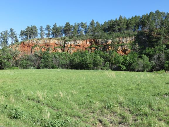
| Red rock cliffs. |
 |
Baby burros!!
|
 |
So cute.
|
 |
Here's mama.
|
 |
But wait, there are more!
|
 |
Another little one. Just adorable.
|
 |
And here's what it REALLY looks like!
Lots of people. I did not have them to myself.
|
 |
And another mama and baby.
|
We drove on a little farther and found the pronghorns.
The pronghorn were hanging out near the buffalo corrals. Once a year, there is a buffalo roundup to cull the herds. Here is a sign that tells about it.
So now you know what a day with Susan and Bob looks like. I hope you enjoyed your tour of the area around Custer City, South Dakota.
Tomorrow, we have tickets to Crazy Horse Memorial. Travel Bug out.