After my fall yesterday, I slept well overnight. This morning, I'm game to try the 5k Bertha Falls Trail in Waterton-Glacier International Peace Park. Again this morning, my pelvis/coccyx hurt when I climbed into the truck. I was fine for the 40-minute ride to Waterton Townsite. I still couldn't tell EXACTLY where I hurt, it was more a generalized hurt around my tailbone.
The weather today was perfect for hiking. My allergy to cold temperatures usually makes me dress warmly. Today, that worked against me. I had on long pants, a Rugby shirt, and warm socks. I did not wear a T-shirt under my sweatshirt. I also did not take my windbreaker.
 |
| Bertha Falls Trailhead |
 |
| We were not going high enough to be impacted by avalanches. |
The day was mostly cloudy and we started the hike at about 60 degrees. The first part of the trail was shaded in the forest.
When we got to the exposed slopes, the sun came out. That, in addition to the steepness of the trail, really warmed us up. The cold water we carried tasted excellent.
I found that going up steep inclines caused quite a bit of pain in my tailbone region. The hike took a lot out of me because the fall put my body through quite a bit of stress yesterday.
The spectacular scenery helped take my mind off the aches and pains. We climbed steadily, and sometimes moderately steeply. Both of us thought the trail was going to be easier than it was.
In the following two photos, you can see how forested the eastern side of the lake is. The fire did not impact the east side much.
 |
| Upper Waterton Lake looking toward Glacier National Park in the U.S. |
 |
| Vimy Peak as seen from the Bertha Falls Trail. |
The west side of Waterton Lake is where the 2017 fire came through. You can see that most of the trees here are burned. That, of course, makes it easy to see the spring freshets and waterfalls coming off the high mountains.
 |
| An ephemeral waterfall. |
 |
| The Bertha Falls Trail (not much shade here). |
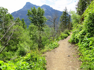 |
| The Bertha Falls Trail. |
 |
| Can you believe it? There's a water skier. The lake is melted glacier water! Brr! |
 |
| Another lovely seasonal waterfall. |
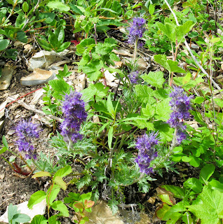 |
| Silky phacelia (Phacelia sericea). |
We continued up the trail and came to a viewpoint of the lake and mountains. Just beyond that, the trail split. Heading south would take you to the U.S. border.
 |
| A bench with a view of Upper Waterton Lake and surrounding mountains. |
 |
| A wide viewpoint of the surrounding mountains and Upper Waterton Lake. |
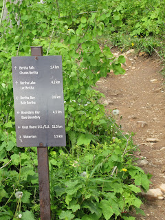 |
| We chose Bertha Falls. |
As we continued up the slope, we came to an area where the rocks were interesting colors - light yellow and blue.
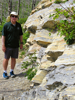 |
| A section of rocks that are unusual colors. |
 |
| The layers are light yellow and light blue. |
 |
| Love this! |
We just kept going and going. There's a waterfall up ahead somewhere!
 |
| Aha! a gorgeous waterfall. |
I thought we had made it to Lower Bertha Falls. Since we had never been here before, we debated if this was really it. We had another kilometer to go according to our pedometers.
Bob didn't think this was big enough to be Little Bertha Falls. So he went up the trail to see if there was another waterfall close by. He no sooner went around a corner 50' ahead when he frantically motioned for me to follow him.
When I got around the corner, lo and behold, there was Little Bertha Falls. It's certainly NOT little in my estimation! This is unique in that the water at the bottom of the falls funnels through a V-shaped rock trough.
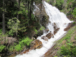 |
| Little Bertha Falls (not little!). |
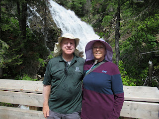 |
| Bob and I still chasing waterfalls, 39 years and counting. |
Yay, we made it. We spent quite a bit of time here absorbing the wonderful negative ions. Unfortunately, at some point, we had to head down.
When we were almost back to the trailhead, we encountered this lovely doe. She was much more interested in eating plants than in us. We walked past within two feet of her!
From Waterton, we headed back to Cardston where we will have lunch and do two 5k Cardston town Volksmarches.
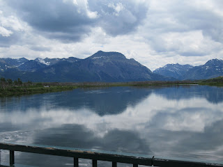 |
| Middle Waterton Lake. |
It was nice to finally see a reflection in Middle Waterton Lake after a few days of high winds. For our last day in Waterton-Glacier International Peace Park, we considered this view a nice send-off.
After lunch, we walked over to the Remington Carriage Museum to start our 5k Temple Volksmarch. Normally, the walk starts at the Husky Station, but we could walk to the carriage museum and start the Temple walk there.
I wasn't able to take pictures outside the museum yesterday because it was pouring rain, so I took them this afternoon.
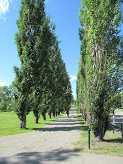 |
| A carriage path in front of the museum. |
 |
| Sculpture of Seabiscuit and Woolf titled "So long, Charley." |
 |
| The history of Seabiscuit's win at Pimlico. |
 |
| These signs are along the carriage paths. |
 |
| The shared bridge over Lee Creek. |
 |
| Information on Fay Wray. |
The fountain was old, had trash in it, and wasn't working. It wasn't worth a picture.
 |
| A&W is across the street from Fay Wray's info. |
 |
| The Card Pioneer cabin. |
Zina Young Card was the founder of the settlement here and local leader of The Church of Jesus Christ of the Latter-day Saints. You can read more in the history markers.
 |
| A mural next to the Card home. |
From here, we walked through part of Main Street and then turned to go up a hill into a neighborhood. There was an excellent view of downtown Cardston.
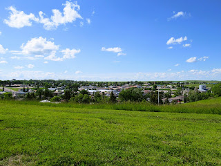 |
| Cardston's historic downtown sits in a valley or bowl. |
 |
| Looking across downtown, we could see the Mormon Temple on another hill. |
After finishing our first 5k (which was the 10k Temple route shortened to a 5k by not going to the Agridome or the Temple), we did a second 5k on the bike path. It started at the Remington Carriage Museum, we walked along Lee Creek all the way to the Golf Course cart bridge and back to our campground.
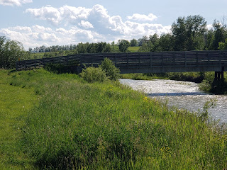 |
| Lee Creek as seen from the path behind the carriage museum. |
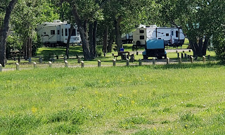 |
| Our 5th wheel is on the left at Lee Creek Campground in Cardston. |
 |
| Lee Creeek as taken from the carriage bridge with Chief Mountain in the background. |
 |
| Looking across Lee Creek at the Lee Creek Campground. |
As we walked along Lee Creek, three teen-aged boys invited us to go swimming in the creek. We told them no because the water was too cold. (We're talking probably snowmelt coming down from the mountains.) They assured us that the water was fine. And what kind of Cardstoners were we anyway if we didn't want to swim in the creek.
 |
| One type of fish in the creek. |
 |
| Meadowlarks live here. |
 |
| A road bridge over Lee Creek. |
 |
| One of numerous trails leading from the bike path and creek up to neighborhoods. |
 |
| Looking back at the RV park from a hill on the bike path. |
 |
| Two trails here. |
 |
| Creekside Pedestrian Pathway. |
As we passed under the roadway bridge, Bob told me he had seen an owl here. Guess what? I think this is where the owl lives!
 |
| Lovely owl. Maybe a young Great Horned Owl? |
 |
| Bob on the pedestrian path alongside Lee Creek. |
 |
| Lee Creek and the rural countryside. |
 |
| Lee Creek looking toward part of the golf course on the hill. |
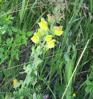 |
| Common toadflax; Butter-and-Eggs (Linaria vulgaris). |
 |
| This golf course has lots of hills. It looks very difficult! |
Going back under the road bridge, we found the owl again. This time it was facing away from us with its head swiveled backward!! Wow!
 |
| Maybe a young Great Horned Owl? |
We returned to the campground and called it a day. When we finished both Cardston walks, we had 10k on our pedometers. That makes it a 15k day including Lower Bertha Falls.


No comments:
Post a Comment
Please let me know what you think, your experiences, and constructive criticism to make this blog stronger.