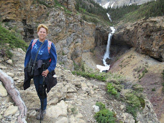
The Crypt Lake Trail is described as strenuous and challenging. It was voted Canada's Best Hike in 1981 and rated in the Top 20, "one of the world's most thrilling trails," by National Geographic in 2014. We can attest to those descriptions! And we didn't make it to the most thrilling parts: the metal ladder bolted to a wall, the 100'-long natural tunnel, or the narrow cliff trail with the cable to hang onto.
But let's start at the beginning. In order to get to the Crypt Lake Trailhead, you have to take a 15-minute boat ride with the Waterton Shoreline Cruise Company across Upper Waterton Lake. The price in June 2022 was $31 Canadian roundtrip per adult. You could buy your ticket up to three days in advance. When we went it was still slow season and we didn't have a problem buying our tickets the morning we went. However, we have heard that in mid-summer, you need to get there early or buy your tickets in advance at the Waterton Village Marina. Be sure to check the cruise schedule as it changes at different times of the year.
If you go, be sure to take plenty of water. The average amount of time spent hiking to Crypt Lake and back is seven hours. Take a backpack, sunscreen, lunch, snacks, hiking poles, a hat to protect your face and head from the sun, and wear layers of clothing. If there is a chance of showers, take a poncho.
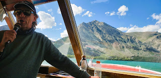
We boarded the boat which was staffed by the captain and a narrator. The narrator told us what to expect on the hike and what flowers and animals we might see.
He said bears had been spotted on the trail. His best advice was that all the bears care about right now is eating. The black bears eat plants, lots and lots of plants. We were instructed to talk, sing, and make human noises; no bells because they make the bears curious, and no whistles because they sound like the bears' prey--prairie dogs, ground squirrels, chipmunks, etc. If we talk and make noise (like clacking walking sticks together), it lets the bears know we're in their neighborhood. They can then avoid us.
 |
Waterton Shoreline Cruise Company boat
after dropping us off at the trailhead. |
When the boat docks, you can use the porta-potty at the trailhead. Fast hikers like to sit at the back of the boat. That way, they can be first on the trail so as not to be stuck behind slow hikers. Our boat was not full, only about 20 people. There was a group of nine hikers that traveled together. We kept piggybacking on the trail with them.
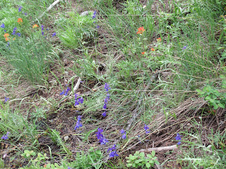
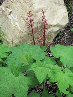
Wildflowers were in bloom and we saw nature's palette of colors while we hiked.
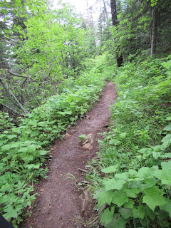 |
| Lush forest at the beginning. |
 |
| Fairy Bells (Prosartes trachycarpa). |
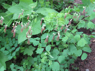 |
Western meadowrue (Thalictrum
occidentale). |
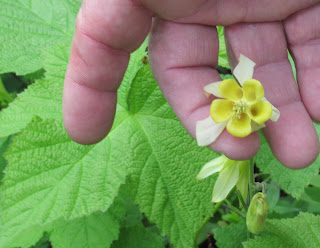 |
Yellow columbine (Aquilegia
flavescens). |
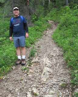 |
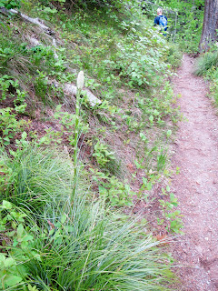
You can see how rocky this
trail is. |
 |
| Oregon grape flowers. |
 |
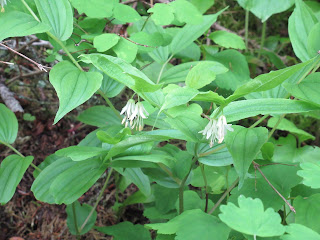
Bare root False Solomon's Seal
(Maianthemum racemosum). |
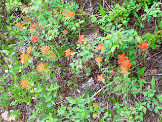 |
Scarlet Indian paintbrush (Castilleja
miniata). |
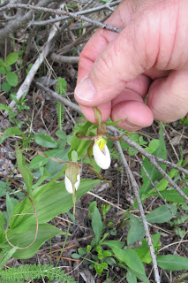 |
Mountain lady's slipper
(Cypripedium montanum). |
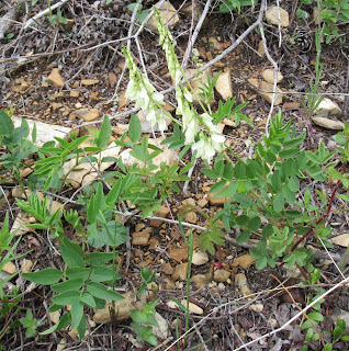 |
American milkvetch
(Astragalus americanus). |
The early part of the trail switchbacked up through the forest and was not terribly steep. We passed the side trail to Hell Roaring Falls on the way up. Our narrator on the boat told us it was best to go down on the Hell Roaring Falls trail, so that's what we decided to do.
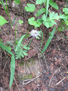
The wildflower show continued. According to our narrator, there are 600 types of wildflowers in these mountains. Don't worry, we didn't see all of them.
 |
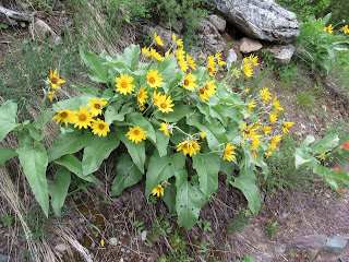
Arrowleaf balsamroot
(Balsamorhiza sagittata). |
 |
Round-leaved alumroot
(Huechera cylindrica) and
Scarlet Indian paintbrush. |
 |
Western virgin's bower
(Clematis occidentalis). |
 |
The leaves look like a strawberry plant.
I have no idea what this plant is. |
 |
| Arrowleaf balsamroot. |
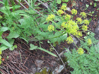 |
Indian consumption-plant
(Lomatium nudicaule). |
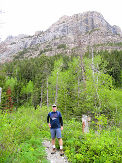
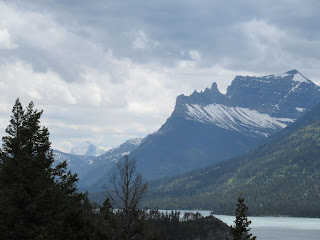
When we came out of the forest, expansive views of the Canadian Rockies and Upper Waterton Lake greeted us.
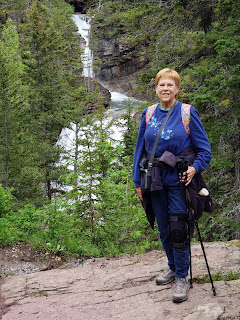
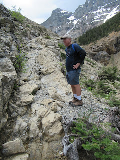
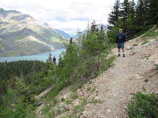 |
Bob on the Crypt Lake Trail. You can
see how high we've come up from the lake! |
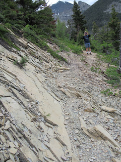 |
| Rocky, shale-like trail. |
 |
| Dramatic peaks. |
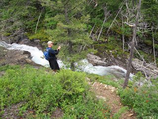
The first major waterfall we encountered was Twin Falls. There was a small side trail that was perfect for taking photos at the overlook.
 |
| Me at Twin Falls. |
 |
Bob at the Twin Falls
Overlook. |
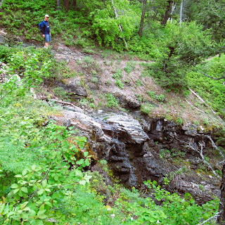
We encountered numerous freshets and rills bringing water down the mountains from the snowpacks. We had to ford three streams. Luckily, we were able to hop on rocks to get across the water. Our feet didn't get wet! (Hiking poles added stability to the rocky crossing.)
 |
| Me by one of the freshets. |
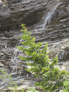 |
An ephemeral (seasonal)
waterfall. |
 |
Here's one of the streams we
had to ford by rock hopping. |
 |
This is not one of the
four major waterfalls.
|
Let's continue on the hike. We're at the point where we have to keep looking around and back at the gorgeous views. We had clouds almost all day that kept us cool in the open areas. I imagine in the summer it gets pretty hot on all the exposed slopes.
 |
| More water falling. |
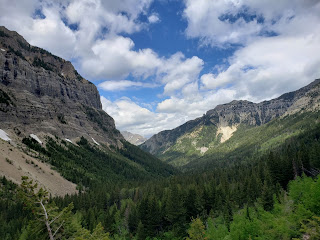 |
We came all the way up that canyon
from Upper Waterton Lake! |
 |
Bob standing above another
seasonal waterfall. |
 |
This part of the trail is
more out in the open. |
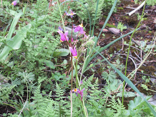 |
Pretty shooting star
(Dodecatheon pulchellum). |
 |
| A wildflower florist shop. |
 |
Beargrass getting
ready to bloom. |
 |
Lyall's scorpionweed
(Phacelia lyallii). |
By this time, we had been hiking for about 3-1/2 hours. I was tired, exhausted really. I had already eaten an apple and half of my peanut butter and jelly sandwich. We were surprised we hadn't reached the ladder, the tunnel, and the cliff. But we kept on keeping on. One foot in front of the other.
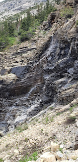
Next, we came to Burnt Rock Falls, the second of the four major waterfalls. It was very windy here. The wind was hurtling up through the canyon and blowing small bits of gravel around. I got a tiny piece in my eye. That was irritating for about ten minutes.
 |
| A rocky talus slope. |
 |
| Bob at Burnt Rock Falls. |
 |
Me at Burnt Rock Falls. (Look at my hair
blowing straight back! Hairstyle by
Mother Nature.) |
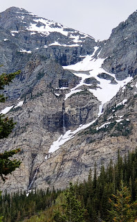
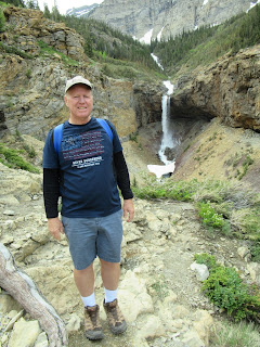
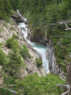
We continued climbing, thinking surely we must be getting close to the third waterfall. Up, up, up the rocky switchbacks we went. Ultimately, Crypt Falls came into view. OMG. The trail descriptions did not prepare us for a 574' waterfall! Wow! Looking out across this valley, we realized we STILL had a long way to go to get to Crypt Lake. The lake is upriver from that waterfall! It's still a valley away from us. Holy smokes.
 |
| Crypt Falls (574 ft.) |
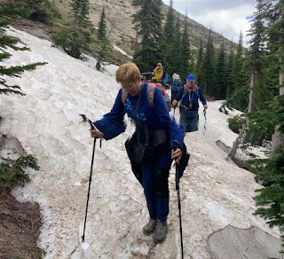
We decided to keep hiking a little longer to see if we could make it to the ladder and tunnel. What came next stopped us in our tracks. As we climbed higher up, we started encountering patches of snow. At first, the patches were small and we could get around the edges of them. But then, we had to walk through them. At first, there were some old footprints that I could put my hiking boots in, but the warming trend made the snow slick. We made it through the first snow patch. It wasn't dangerous because there were bushes on the side of the trail with no drop-off.
Next, we came to a much bigger snowfield with the trail going right through the middle of it. I was able (very carefully, mind you), to make my way about 50' out into the snowfield to a tree, but it was slushy and very slippery. Scary slippery.
At that point, we saw people returning back down the trail. They were about 50 ft. above us because they couldn't find the trail on their way back due to the snow. They were glad we were there.
We asked them how the conditions were ahead and they said, "Not good." There was a lot more snow so they turned back. One of them had fallen, slid down a slope, and was able to grab onto a tree. They had "icees" (what we call crampons). We did not. They couldn't believe we were up in the snow without them. There was quite a slope down the snowfield and I didn't want to slip and end up 100 ft. down!
Bob and I turned around. I used my hiking poles to make little indents in the snow where I could put my boots. It was slow going. Finally, when I got closer to the dirt, I "skied" in my hiking boots back to the trail. Bob used a different method. He didn't have poles, so he got down on one knee and slid the other leg ahead, and continued with that plan of assault until he got to solid ground.
 |
| In the bigger snowfield. |
 |
This is where I used my hiking boots
to "ski" down a little drop to the bare trail. |
Our time on the trail so far was four hours. We were dropped off at 9:15 am and the only return boat for the day would be at 5 pm. It was time to eat lunch and then hightail it back so we would have time to do the Hell Roaring Falls part of the hike.
 |
We had lunch at the Burnt
Rock Falls overlook. |
 |
Bob's eating his peanut butter and
jelly sandwich. What a view! |
 |
The bright orange on these rocks is
lichen. Lichen helps break down rock. |
 |
More wildflowers! Common harebells
(Campanula rotundifolia). |
 |
Spotted coralroot
(Corralorhiza maculata). |
On the way down the trail, we took the side trail to Hell Roaring Falls which looped back to the main trail closer to the boat dock. We had been told it was more overgrown and not maintained as well. It also was steeper which is why it was recommended we see these falls on the way down.
They were sure right about the trail. We had to be careful of rocks and roots, steep descents (on one, I had to have Bob hold my hiking poles so I could use both hands to hold onto the rocks while I climbed down that part).
 |
| Hell Roaring Creek. |
 |
| Bob taking photos of Hell Roaring Falls. |
 |
| Hell Roaring Falls. |
I'm telling you, I was completely exhausted at this point. That is not a good state to be in when you're going down an unknown, overgrown, steep trail. I fell twice. The first time I think I tripped over a root or rock and fell forward into soft plants. The second time, my hiking pole got caught in my shoelace and I fell forward with my left knee landing on my hiking pole. I was stuck because my hiking pole was under my knee and the hiking pole was stuck in my shoelace. Bob had to help me up. I cried because I was so fatigued and embarrassed, but I was not hurt.
 |
We are almost back down to the lake!
|
In about 1/2 mile, we were back at the boat landing area. I was so happy to sit down on a log. It was 3:30 p.m., so we had plenty of time before the boat came to pick us up. We ate our apples and drank water.
 |
On the boat dock.
We made it back in time! |
 |
| Some of the other hikers. |
The wind was still quite strong, so the boat captain had to deal with some whitecaps on the lake. He had a tailwind. Our narrator talked to us for about ten minutes on the return trip about bear reproduction. It was fascinating. We enjoyed relaxing on the boat.
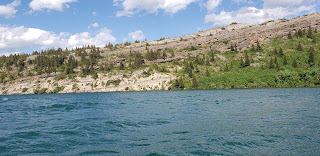 |
Upper Waterton Lake as seen
from the boat. |
 |
| Our cruise narrator. |
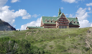 |
| Prince of Wales Hotel. |
Once we landed, we headed straight for the 5th wheel. We made a nice campfire and had hot dogs, potato salad, BBQ chips, and S'mores for dessert. It was a pleasant evening to sit outside. And, bonus, there weren't any bugs!
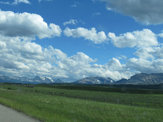 |
Our view of the Rockies on our way
back to Cardston, Alberta. |
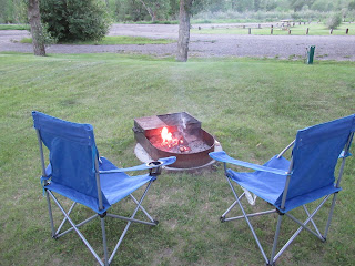 |
| Here's our inviting campfire. |
I think it's time we call it a day, don't you? A nice glass of blueberry Moscato goes down real easy. (Oh, as a side note, the county that Cardston is in is a dry county...no alcohol sales at all. The closest place to buy alcohol is in Waterton Village, 35 minutes away.)
That's all folks. If you want a challenging hike, Crypt Lake Trail is for you!


No comments:
Post a Comment
Please let me know what you think, your experiences, and constructive criticism to make this blog stronger.