Today's the day I get to check off one of my big bucket list items: Gila Cliff Dwellings National Monument. The weather is supposed to be beautiful for walking today, sunny and 54 degrees with a mild wind.
From Silver City, New Mexico, the drive is 45 miles on a winding, mountainous road at a high elevation. The drive time is about one hour and forty minutes.
On the drive there, we stopped at a high-elevation viewpoint to admire the expansive views!
 |
| Expansive views from the viewpoint. |
The twisting, narrow road had a number of hairpin turns. The road is not recommended for large trucks or RVs, although we saw a number of RVs on the way to different campgrounds. There must be a different way up than the way we went in the car. We did see another road join up with the one we were on, but we didn't go that way to see if it was a kinder, gentler road.
When we got close to the cliff dwellings, there was a point of interest about an ancient Mogollon (pronounced muh-GEE-yon) village. We got out, read the signs, and looked at the layout of what a village might have looked like. Construction of the highway removed all the prehistoric and historic structures that had been revealed by archaeologists during an excavation (prior to 1966) by the Museum of New Mexico.
The Mogollon people left this area about 1300 CE. Their descendants are the Puebloan Hopi tribe of Arizona and the Zuni and Acoma Pueblos in New Mexico.
 |
| Susan Medlin checks out where the walls were. |
 |
| Views of the surrounding cliffs. |
A couple of miles later, we arrived at one of the two visitor centers at Gila Cliff Dwellings National Monument. This visitor center is a left turn off the main road here. It has a gift shop and the National Park Stamp (very important for those of us with a National Park Passport Book!).
The parking lot was very empty at this time (9 am when the Visitor Center opened). It was chilly at this high elevation even though the photo makes it look warm. |
| Our first look at the cliffs where the dwellings are. |
 |
| The first of two Visitor Centers. |
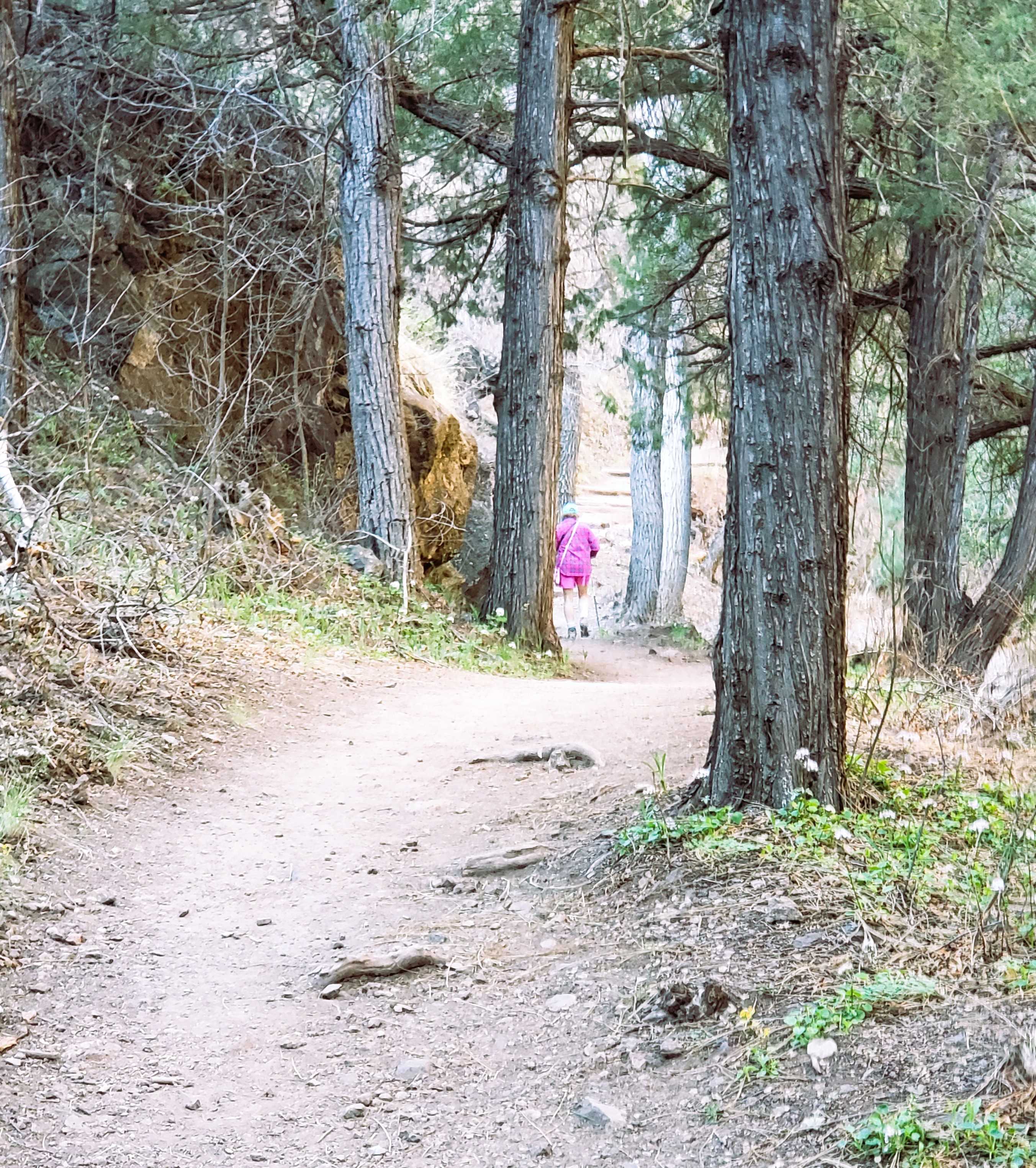
After getting information from the Park Ranger (NO food, gum, or drinks on he trail!), we had to take our water and snacks back to the car! After that, we could start on the one-mile, round-trip hike to the cliff dwellings. We started out by crossing over the Gila River and hiked up the canyon.
 |
| Susan Medlin on the bridge over a side creek. |
 |
| We followed the creek up the canyon. |
 |
| A beautiful day for hiking! |
 |
| Susan M. leading the charge up the trail. |
 |
| Wildflowers. |
 |
| Nice shade in the morning. |
 |
| Some people in our group saw a rattlesnake! |
 |
| Our first view of the cliff dwellings. |
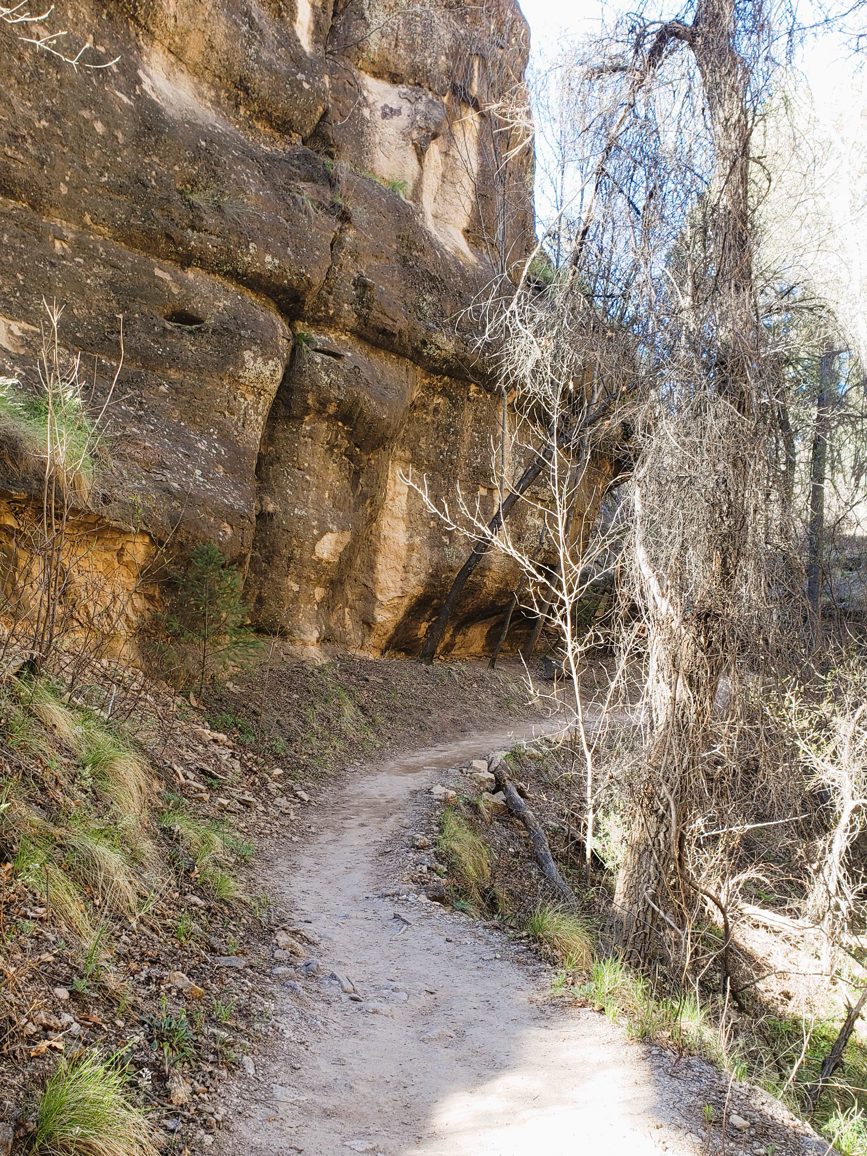
We had to hike up out of the canyon which included a number of stone stairs. |
I'm lollygagging and taking photos
(and huffing and puffing). |
 |
Quite the cliffs. They're not nearly as high as
Mesa Verde National Park, but still pretty. |
 |
These awesome wildflowers have tubular flowers
that go from blue to purple. |
 |
| One of the entrances to the cliff dwellings. |
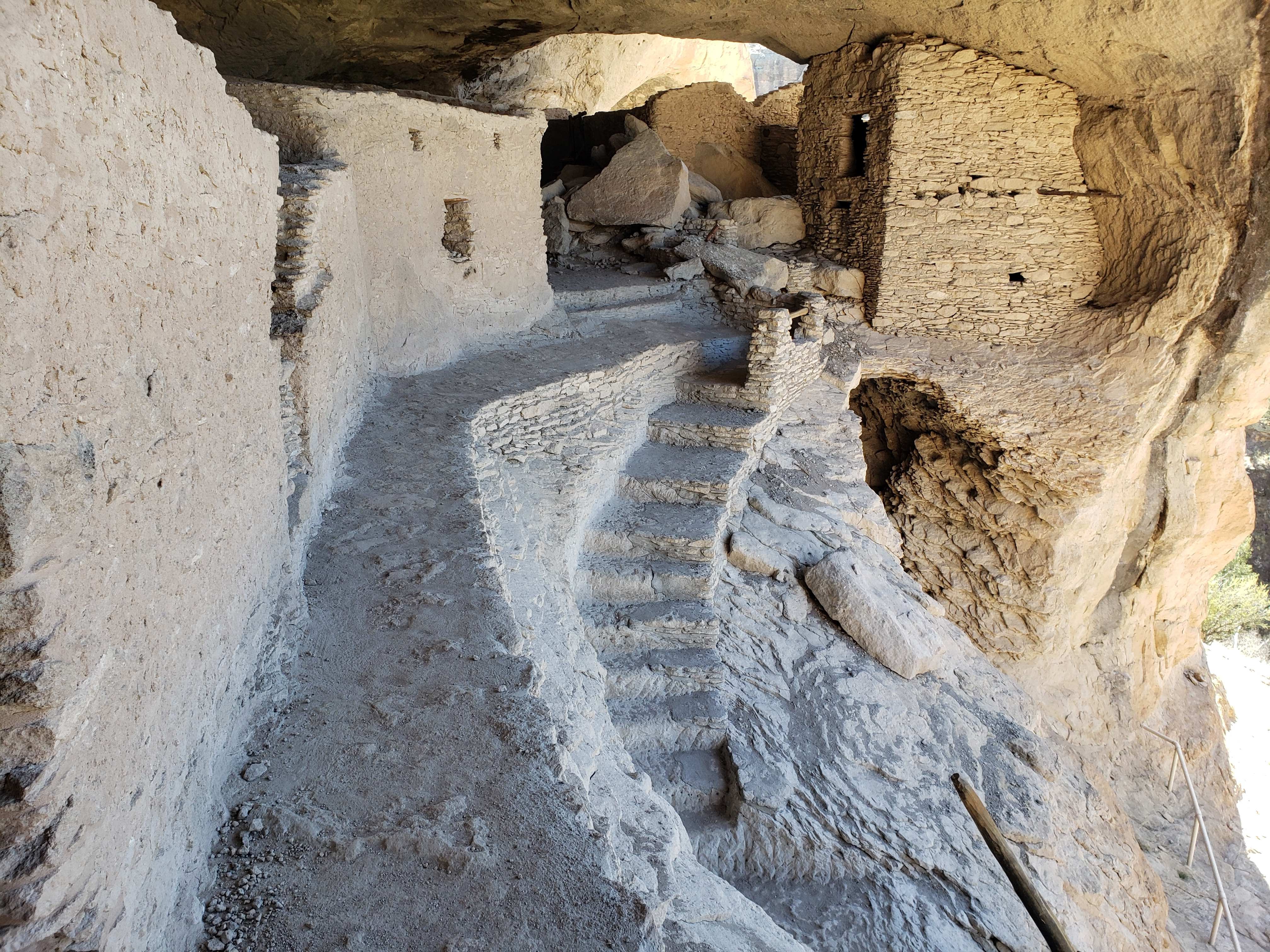
The Gila Cliff Dwellings are very well preserved. We were able to climb up, in, and around the dwellings. And then, we took a long ladder down! |
| This is the main entrance into these rooms. |
 |
| You can see it's quite large. |
 |
And, we're up quite high.
|
 |
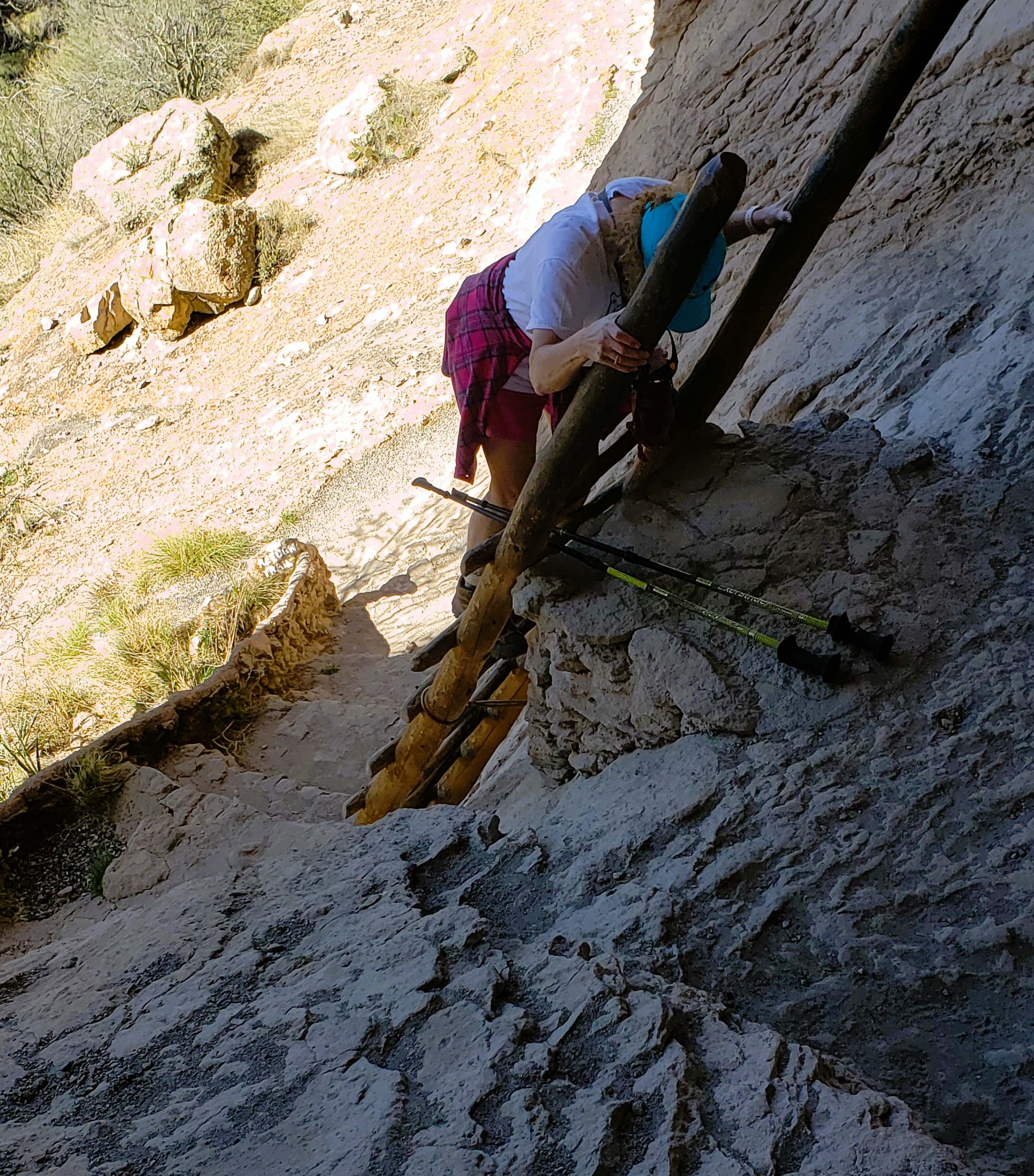
| We walked along this ledge. No guard rails here! |
 |
A pretty view through a "window" looking
across the canyon. |
 |
Little ladders allowed us to climb up
and look in rooms. |
 |
The long ladder down. [Note: We could
have gone out the way we came in.] |
 |
| This is the ladder we came down. |
We finished the loop back to the Visitor Center, spent a few minutes walking along the beautiful Gila River, and had a picnic lunch. We then drove down the road to a shorter trail to see a pictograph and a very small "cliff dwelling" (no cliff involved). |
| Our trail down. |
 |
| Lots of steps down. |
 |
Susan on the trail back to the
parking lot. |
 |
| Susan Medlin on the trail, now in full sun. |
 |
| Looking down at the bridge over the Gila River. |
 |
| We're still going down. |
 |
Susan Medlin on the bridge over
the Gila River. |
There was a longer walk we could have done from this point, but we decided to spend a few minutes along the river. Then we used one of their picnic tables to make sandwiches.
 |
| The other trail here was up around the mountains. |
 |
| The bridge over the Gila River. |
The sweet sound of the rapids in the river was our background music during lunch.
At our next stop, we took the short "Trail to the Past" to see rock paintings in one direction and a small cliff dwelling in the other direction.
 |
| Susan Medlin searches for rock paintings. |
 |
| Gila Cliff Dwelling Visitor Center #2, |
We headed back to Silver City along the road we came in on. A couple of different roadside signs enlightened us about the Chiricahua people and Alum Mountain.
 |
| Alum Mountain is in the center of this landscape. |
And just so you know, aluminum is NOT made from alum.
The Continental Divide Trail (CDT) was our next conquest. The section of the trail we were given directions to was quite a way from Gila Cliff Dwellings. We heard the road to that trailhead was long and rough, and the trail was hard to follow.
On our way to that destination, we saw a sign alongside the road we were on pointing to Arrastra Trail 74. Being inquisitive, I turned onto the dirt road to see what was there. It turns out, the Continental Divide Trail goes through there. It had a small parking lot. We saw a couple of ladies (not from our group) heading back to their car and we asked them about the trail. They said it was nice and not too steep. We thanked them and I started driving back to the highway.
Susan Medlin said, "Why don't we do our Continental Divide Trail here? I mean it." So I turned the car around, parked, and we did 7 km on this portion of the CDT. I have a couple of photos of the hike we did.
 |
| Susan Medlin showing the trail name. |
 |
| Yes, it's the real deal! |
 |
| Continental Divide Trail #74. |
 |
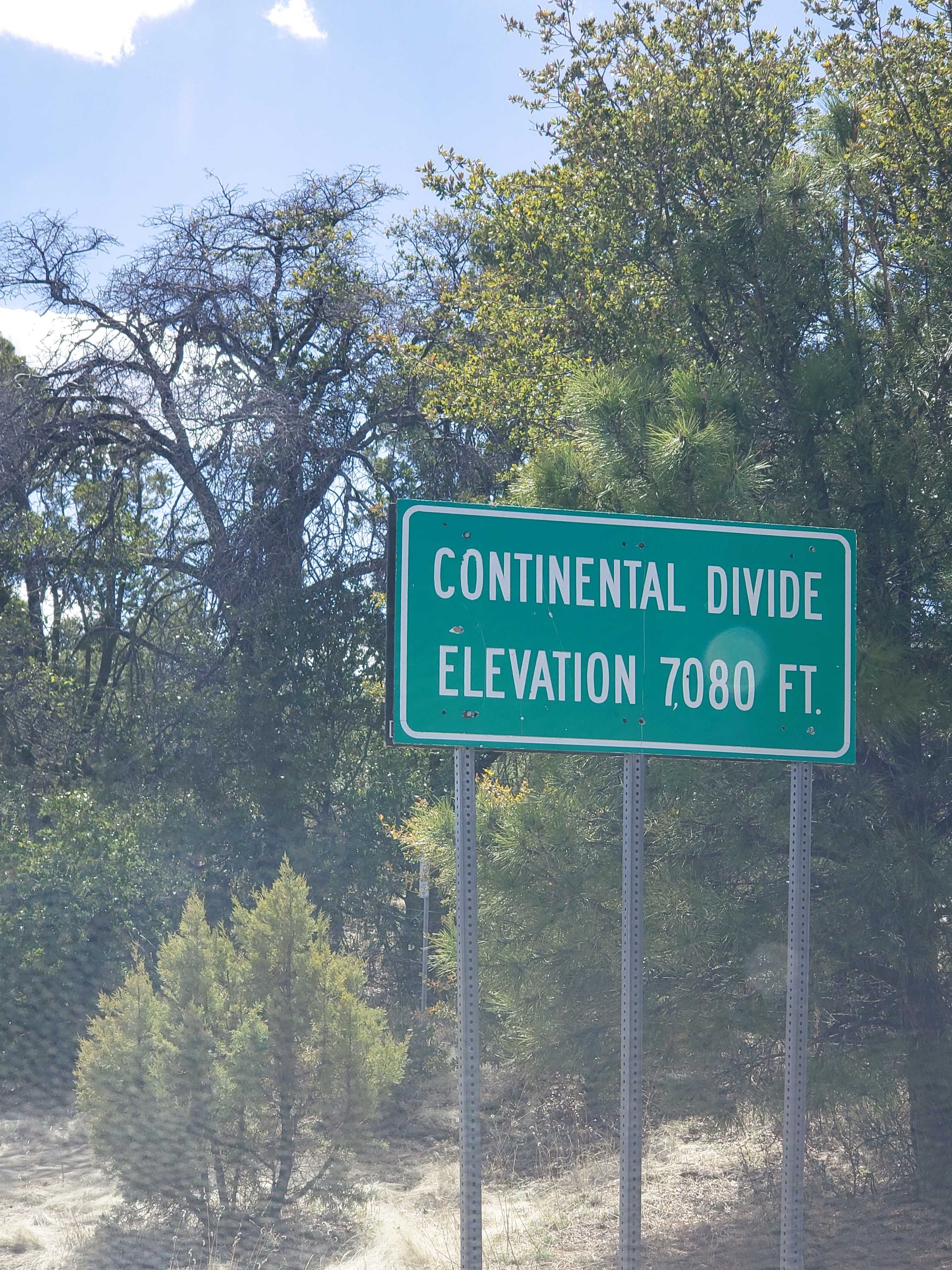
As we headed back to Silver City on the highway, we
crossed the Continental Divide. |
We headed to the hotel, showered, rested, and then went to our group dinner at Q's Southern Bistro in Silver City. It was an adventure in dining because they assigned a brand-new waitress to our table. A number of items had to be sent back, but eventually, we (mostly) got what we ordered. My food was very good!
What a great day!


No comments:
Post a Comment
Please let me know what you think, your experiences, and constructive criticism to make this blog stronger.