Be forewarned...you are going to be reading a lot of history in today's two blogs!
Having been in the area since Thursday, Susan Medlin and I were raring to explore Silver City and Fort Bayard. When we parted yesterday, we planned to visit Fort Bayard first thing in the morning and then do the Silver City walk. Susan came to my car and said we would do the Silver City 10 km Volksmarch first. Whatever.
The walk started at the Murray Ryan Visitor Center. The exterior of the building is a work of art showcasing the Continental Divide Trail, Gila River, native plants, and the Apache and Mimbres cultures. The artwork was done by the town's Youth Mural Program. The visitor center gave me two brochures detailing the art program.
 |
| Silver City, New Mexico's Youth Mural |
 |
The top and bottom tiles were made by students
and depict the history of the Apache. |
 |
This mural represents the Gateway to the
Continental Divide Trail (CDT). |
Other art and history graces the exterior of the visitor center. This area was once a lush, grassy cienega (or wetland) and attracted humans for at least a thousand years. Early Spanish explorer Juan Antonio Garia reported in 1779 that La Cienega de San Vicente was "a summer settlement for wood cutters, sheepherders, and Indian traders." More on this later.
Mining activity in the region began in 1804 with the Spanish development of the Santa Rita del Cobre Mine twelve miles to the east. Copper was delivered to Mexico City by mule train. (That's a long haul!)
The historical marker about the Army of the West tells what happened during the War with Mexico in 1846. General Stephen Watts Kearny, commander of the Army of the West, led his troops, scout Kit Carson, and a staff of topographical engineers through what would become Grant County. On October 18, they held council with Chiricahua Apache leader Mangas Coloradas near Santa Rita del Cobre Presidio. Previously employed at Santa Rita and familiar with the area, Carson led them to San Vicente de la Cienega, today called Silver City, before heading westward along the Gila River to California.
On November 16, 1846, Lt. Colonel Philip St. George Cooke, Antoine Leroux, Jean Baptiste Charbonneau, other scouts, and the Mormon Battalion of Volunteers including four wives, traveled a more southern route. They camped near Cooke's Peak, later called Cooke's Spring. Their orders were to blaze a wagon road to the Pacific. The 1858-1861 Butterfield Overland Mail followed portions of Cooke's Road.
Later in the 1860s, explorers and territorial boundary surveyors noticed signs of other mineral deposits, triggering a gold rush in nearby Pinos Altos. In 1870, miners from across the continent poured in by the hundreds with news of a silver discovery in the hills near La Cienega de San Vicente. Silver City became an instant boomtown!
Summer monsoons bless the arid Southwest with rain--sometimes violently so. This valley drains the Pinos Altos Mountains and the Continental Divide. Unfortunately, town founders - unfamiliar with local conditions - placed Main Street right in the path of the watershed's natural drainage route. The results were disastrous.
Each year, rainstorms caused damage to the main thoroughfare; each year, residents made repairs to the unpaved street. With each passing storm, Main Street wore deeper. It became an arroyo, a gully, and eventually a gorge.
No one realized that the problem lay not in the rainfall, but in the uncontrolled wood cutting and grazing of the surrounding watershed. Wood was harvested to heat homes and power steam engines for the mines. Soil collection for adobe bricks made matters even worse.
After the major flood of 1895, the town gave up on Main Street and built a pedestrian footbridge over what is now San Vicente Creek. In 1902, another devastating flood carved the deep gulch that locals now call the "Big Ditch."
The parking lot at the visitor center is where our walk directions started. We passed by another art installation. This consisted of chicken wire holders along the visitor center wall. The chicken wire holds hundreds of small clay figures. An exhibit inside the visitor center explained this art project.
 |
| Close-up of the clay figures. |
 |
| Explanation of "The People and Clay." |
Next, we passed by and looked inside the Billy the Kid Cabin. The cabin is typical of the late 1800s, where Billy the Kid and his mother lived. The cabin was used in the movie "Missing" and donated to Silver City by director Ron Howard. |
| Billy the Kid Cabin. |
 |
| Inside Billy the Kid Cabin. |
You have learned about how the Big Ditch formed. Now, you will get to see it up close and personal. The following five photos let you experience the first part of our walk.
 |
| Susan Medlin hiking the Big Ditch Trail. |
 |
| Wildflowers. |
 |
| It was nice and cool in the "Big Ditch." |
 |
Susan Medlin crossing a pedestrian bridge
over the Big Ditch in Silver City, NM. |
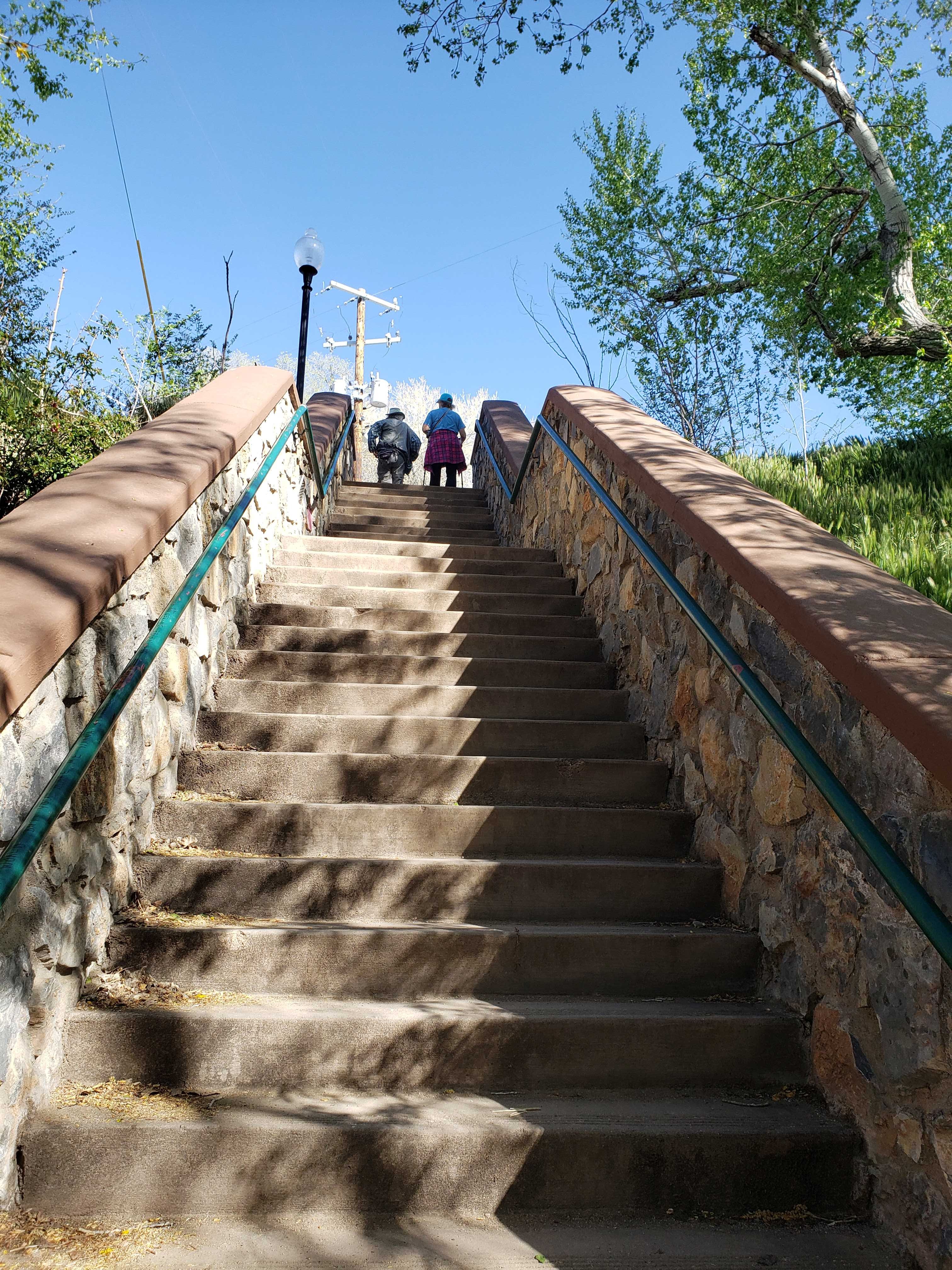
From the Big Ditch, we went up a long set of stairs to find the sign for Lions Park. Didn't see it, wandered around a bit, and eventually found it. I went off on my own up a steep hill to a bridge; Susan Medlin, Regina, and Sarah Gregory Long all went into town a different way.
 |
We went up and down these stairs while
looking for the Lions Park sign. Didn't see it. |
 |
| We saw this gorgeous mural. |
Just after the above mural is when we split and went different ways. I ended up at the mural below on a bridge. There was a steep dirt trail up to the bridge. No one else wanted to attempt it, so they all turned around. I went up to the street and found out I had gone one block too far on the directions, so I walked back down the street to find the rest of the group.
 |
| The mural on the bridge. |
 |
"Southwest Welcome," 2006,
Youth Mural Art Project. |
In a few blocks, I met up with the group again. Sarah and I walked together and photographed murals and talked about fun stuff. Regina and Susan Medlin took off quickly and left us in the dust. Meanwhile, murals abounded.
 |
"Tour of the Gila" mural (2016) honors cycling and cyclists
in Silver City. |
 |
| Fort Bayard History Mural. |
In the photo below is an artwork called "Five Windows." From left to right, the window titles are Mimbreño Heritage (2007), Apache Heritage (2005), Hispanic Heritage (2009), Anglo Heritage (2006), and Multi-cultural Heritage (2008). Each clay and mosaic window frame is a still life laid out on a checkerboard in a landscape. Each window has a lot of essential images from each culture.
 |
This is where I really wanted to go,
but it wasn't open yet. |
Regina was waiting for Sarah and me at this point. So the three of us walked together. Susan Medlin had struck off on her own. The walk was hilly and we saw lots of surprises. The inner courtyard of Tranquil Buzz Coffee House had a little waterfall.  |
Courtyard of Tranquil Buzz Coffee House -
a delightful spot. |
Here are other sights along the city streets.
 |
| Turtle totem. |
 |
| A beautifully painted windmill. |
 |
The Thomas Conway House, the residence of a prominent
Territorial attorney, built in the mid-1800s by John Flood. |
 |
| I nicknamed this the Rubik's Cube building. |
 |
| St. Vincent de Paul Church, 1874. |
We continued walking up and down hills through neighborhoods until we came to Western New Mexico University. Regina and Sarah wished to use the facilities at the Museum on campus. I went across the street to take photos of the art at the library. Then I sat in the shade, checked my email, and waited for them to come out of the museum.
 |
| Chihuahuan spotted whiptail. |
 |
History of "The Great Race" put on by Western
New Mexico University. |
The following five photos are of an art installation called "A Community Reads" and are located at the entrance to the WNMU Miller Library. Participating community members and students each made a clay book spine of their favorite book. These were glazed, fired, and "stacked" into the mural. The overall design was the conception of Aldo Leopold's YCC mural crew led by Diana Ingalls Leyba. The books chosen say much about Silver City's diverse community.
 |
| Fine Arts Center Theatre (WNMU). |
 |
| WNMU entrance sculpture and fountain. |
 |
| Thomas B. McDonald Student Memorial Center (WNMU). |
 |
"Camp: Endangered Species," 2019,
WMNU Barnard Hall. |
 |
"Camp: Endangered Species," 2019,
WMNU Barnard Hall. |
I walked past beautiful homes, the Grant County Courthouse, and Silver City Museum. I decided to return to the visitor center to use the facilities. It was only a few blocks down the road from the courthouse.
 |
| Grant County Courthouse. |
 |
| Grant County Courthouse. |
 |
| Silver City Museum. |
 |
| Silver City Museum. |
The following gorgeous mural is at the intersection of Texas and Broadway Streets. The mural theme was proposed by Southwest New Mexico Audubon and designed by Aldo Leopold High School art students under the direction of teacher Alison Phillips. The border consists of blue to red stripes indicative of global temperature changes over the last 100 years. The mural illustrates the bees, birds, butterflies, and bats that pollinate the plants on which animal and human lives rely. The black-and-white Mimbreño designs represent the native culture that thrived before climate change some 900 years ago causing drought and crop failure that forced Mimbreños to migrate elsewhere as early as the 12th century.
 |
"Plants, Pollinators, and Climate Change,"
2019, Youth Mural Program. |
 |
A gorgeous new mural is being painted in
downtown on the side of the Toad Creek Brewery. |
When I returned to the visitor center, I decided this would be the finish point for my walk. I had 7 km which was fine with me. Susan Medlin was on the 10 km portion of the walk high on a hill. She said she'd be another half-hour before she would return to the car. I took photos inside the visitor center and then read my emails.
 |
| Back at the Ryan Murray Visitor Center. |
Here are photos from inside the visitor center.
 |
| We definitely need to spend more time here! |
 |
This mural by Carlos Callejo is above the
visitor center welcome desk. |
 |
| A cute display of local birds. |
When Susan got back to the car, we drove down the street to Dairy Queen for lunch. She was so happy to be back in the air conditioning because that last 3 km did her in. The temperature was in the 80s and she hiked up a hill near the end.
This was a very enjoyable walk. It made me want to come back to Silver City with Bob, go to the museums, and take him on a walk around town.
To be continued in Part 2...


No comments:
Post a Comment
Please let me know what you think, your experiences, and constructive criticism to make this blog stronger.