These are the first two walks of eight Louisiana Parish walks this weekend. We will also do a traditional walking event at Clark Creek Natural Area in Woodville, Mississippi, on Monday morning.
The walk this morning in Covington, Louisiana, started at 8:30 am. It was supposed to be fifteen minutes from our hotel in Mandeville ten miles away. We certainly didn't expect the traffic jam in Covington at 8:10 am. It took us 1/2 hour to get to the walk start exactly at 8:30 am.
The walk started at the Tammany Trace Trailhead, part of the Rails-to-Trails Conservancy (this trail is 28.2 miles). The trailhead was at a small park with restrooms and more than enough parking for our group.
The park had a few points of interest: an old water tower, a statue of Ronald Reagan, and a nice gazebo that was decorated for Mardi Gras. While Susan Medlin was signing in for the walk, I roamed the park and took photos.
 |
Covington, Louisiana's
water tower. |
The 29-mile-long Bogue Falaya River flows into the 34-mile-long Tchefuncte River, one of the greatest contributing rivers of the Lake Pontchartrain basin in southeastern Louisiana. Together, the rivers drain a 192.26-square-mile watershed that drains upland pine savannahs and large wetland floodplains.
What the heck is a Bogue? According to Dictionary.com: Is Bogue a real word? "noun Gulf States: a bayou, stream, or waterway." It came from Cajun French, from Choctaw bok ("creek, stream").
Tchefuncte is pronounced chew-funk-te.
 |
| Looks like a foreign language! |
 |
Ronald Reagan statue in
Tammany Trace Trailhead. |
 |
Covington's gazebo is
decorated for Mardi Gras. |
 |
Heading onto the Tammany Trace
Trailhead. |
It was like a starting shot went off and a group of Volksmarchers headed out on the path. Some stayed together for the whole walk, and others split up into smaller groups. Spoiler alert: We all ended up in the same place: the cemetery. LOL.
 |
Regina and Susan Medlin
leading the charge. |
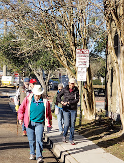 |
The walkers are
spreading out somewhat. |
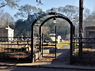 |
| Covington Cemetery. |
 |
St. Tammany Parish Courthouse and
St. Tammany Parish Justice Center. |
 |
| Covington Cemetery. |
Can you tell it's a beautiful walking day? Not a cloud in the sky and a pleasant temperature to boot. After the cemetery, we passed by the St. Tammany Parish Justice Center and continued for eight blocks through neighborhoods.
 |
| Umbrella art. |
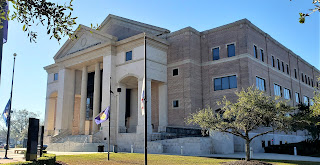 |
| St. Tammany Parish Justice Center. |
 |
A sculpture in front of
St. Tammany Parish
Public School Board
Building. |
 |
St. Tammany Parish Public School
Board Building.
|
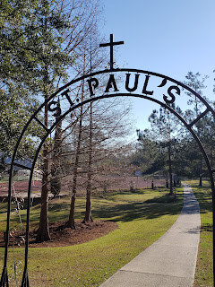
St. Paul's School was our next point of interest. St. Paul's School is a private, all-boys Lasillian high school located in Covington, Louisiana. The school is run by the Christian Brothers and is one of the 1,000 Lasillian schools in more than 80 countries. If you want to know what Lasillian schools are click this link.
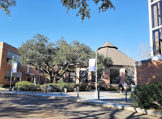 |
St. Paul's School, Covington, Louisiana.
|
 |
| National Blue Ribbon School. |
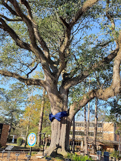 |
A blue-ribbon school with a
blue ribbon tied around the
old oak tree. |
 |
| St. Paul's School grounds. |
 |
| We exited St. Paul's School here. |
Neighborhoods came next, along with a pretty park.
 |
| Tulip trees in bloom! |
 |
| A huge Southern home. |
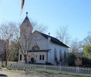 |
| Christ Episcopal School chapel. |
 |
| Covington, LA. |
 |
| Very nice brick house. |
 |
| This house is ready for Mardi Gras!! |
 |
Azaleas are at their peak in
mid-January. Are they crazy? |
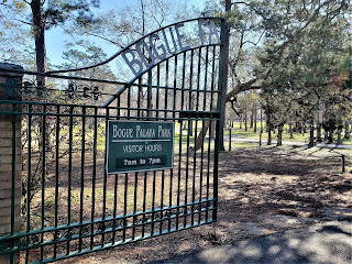
After the Episcopal Church, we turned down Park St. to get to Bogue Falaya Wayside Park. What a lovely stroll we had along the walking path through the park.  |
One of the park's original
gates. |
 |
| Huge playground in the park. |
 |
The walking trail in Bogue Falaya
Wayside Park. The moss glistened
in the sun. Pretty! |
 |
View from the
walking trail. |
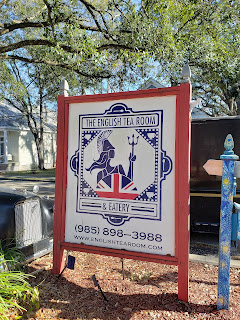
Once out of the park, we entered a cute, eclectic neighborhood (Boston St., Rutland, and Lee Lane) with antique shops, quaint accommodations, and a British Tea Room.
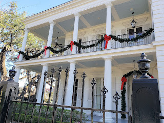 |
| Historic home. |
 |
| The English Tea Room flag. |
 |
| The English Tea Room. |
 |
| "On a Whim" antique store. |
 |
New Orleans Food & Spirits (opening
soon - hopefully for Mardi Gras?). |
 |
| Eclectic Inn - my kind of place. |
 |
I may have to check
out this author.
|
At this point, we were like horses back to the barn, but I managed to snap a few more photos. Covington certainly has charm and history.
 |
We are going back to
the Tammany Trace
Trailhead, not this one! |
 |
Not sure if this is an apartment complex
or a hotel. |
 |
| Lookin' sporty! |
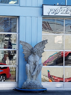 |
| An anguished grotesque. |
 |
| Downtown Covington. |
 |
| A mural capturing days of yore. |
 |
The clock tower and
the water tower. |
Well, we've finished the first 10k walk and burned off a lot of calories. Walkers like to eat and socialize. I heard a partial conversation before we started walking that people were going to have dinner at The Rusty Pelican and it was two blocks from our walk starting point. We thought since it was close, we would go there for lunch. This Covington Rusty Pelican was actually more than two blocks from our starting point. Did we drive the long way 'round?
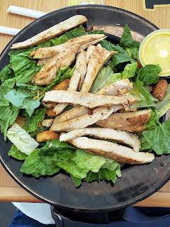
For lunch, I ordered a chicken salad with honey mustard dressing. Susan saw crab cakes on the menu and craved those, along with sweet potato fries. When the food came, I was very happy with my huge salad. Susan was upset because she expected pan-fried crab cakes. Instead, she got deep-fried crab cakes that she did not care for at all. Her sweet potato fries were awesome, though, especially dipped in honey mustard dressing. I had to try one!!
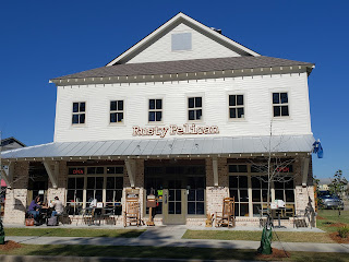 |
| The Rusty Pelican in Covington, LA. |
You know a restaurant is good when the sheriffs and firemen eat there. Three fire trucks, an ambulance, and a couple of sheriffs showed up. Unfortunately, there was a fire call and two fire trucks pulled out just after they placed their order.
 |
| Firemen like The Rusty Pelican. |
One 10k walk down for today. To be continued in Part 2.








Well, this whets my appetite. I get to walk this one next month with Mary on one of her Tator Tours
ReplyDeleteHave fun. Watch the map on the directions carefully. AND, toward the end of the 10k (after the Bogue Falaya Wayside Park), there is a wrong direction in Instruction #23 and #24. Do not go to 21st St. After you exit the park where you came in, turn right at the first street - 19th St. - no sign (I think it's gravel), go to the end of 19th and then back out to the street you were on. That makes instruction #25 correct.
Delete