Anyway, the morning was gorgeous and in the low 60s. We were ecstatic. This trail is a walk in the park, so to speak, compared to the ups and downs, roots, rocks, and mud of the Sol Duc Falls Trail we were on a week ago. This trail is wide and level. It gets steep 1/8-mile from the waterfall. When you get there, be ready to go up and up.
 |
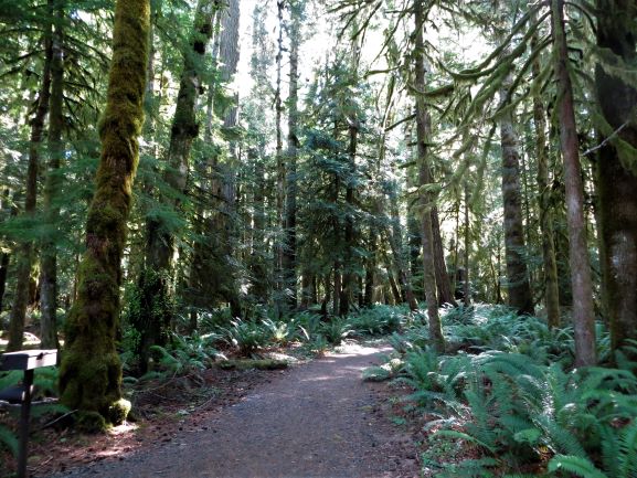
Here's that nice, flat trail.
|
 |
The sun on the moss creates forest monsters.
|
 |
Watch your head under U.S. 101...
low clearance!
|
 |
Nature's sculpture.
|
There are a couple of log bridge crossings, but they are sturdy with railings. As you approach within 1/8-mile of the falls, the trail climbs steeply up steps.
 |
Diane and Bob getting ready to climb.
|
 |
One of the log bridges.
|
 |
| Going up? |
The trail is well maintained and does not feel dangerous. A tip: If you're headed to the falls and getting close, after the first set of stairs you will see a small sign that says "Falls" with an arrow pointing to the left. Straight ahead is a very steep trail with stairs. Take the trail to the left! It is so much easier. We went to the falls on the easier trail. When we got to the falls, we decided to complete the loop and go back to the intersection I mentioned at the top of this paragraph. You will needlessly take A LOT MORE steep stairs both up and down. If you think you will get a better photo of the falls higher up, then only go up to the first turn in the stairs past the first viewpoint. There is an excellent view of the falls from there. Then turn yourself around and go back down the way you came up. Unless, of course, you want to torture yourself or get a great workout.
 |
The first view of the falls isn't much.
|
 |
The view is getting much better.
|
 |
Looking down where we just came up.
|
 |
This is 90-foot Marymere Falls.
|
 |
Must have proof I was there!
[Photo by Bob Alton.]
|
We decided to continue around and finish the loop instead of going back the way we came. Ugh! We wouldn't do that again.
If you think you're going to get a better view at the upper viewpoint, you're not. The next best view is from the bend in the stairs just above the main viewpoint. Then come back down and go back the way you came. Skip all the extra stairs and elevation change!
 |
We went up to a higher viewpoint.
|
 |
Photo from the bend in the stairs
above the main viewpoint. At the bottom
of this photo, you can see people
at the main viewpoint. |
 |
We are heading back toward the lake.
|
|
This is a colonnade tree. (See photo of
"Extended Family" info sign farther down the blog.) |
 |
Description of the Marymere Falls Trail.
|
From the forest, we headed back under U.S. 101 toward the lake and the boat ramp. It was a different world. People were arriving in droves to hike to the falls. When we arrived at the parking lot, it was a zoo of cars, boats, and RVs. The parking lot was full. There was one boat trailer spot left and a small car took it. Not cool. I should have taken a photo of the boat ramp parking area. Wow.
A pick-up with a pull-behind trailer parked on the side of the road, partially blocking it, which would make it difficult for anyone towing a boat trailer to get by. Then they all left the vehicle. People, people, you're not thinking.
The lake is huge, so people can get away from the busy boat ramp once their boat is in the water. We saw kayakers, paddleboarders, and speed boaters.
 |
Lake Crescent's boat ramp.
|
 |
| Isn't the lake's color stunning? |
We couldn't wait to get out of all this hubbub. Back into the forest we went, coming out at the Nature Conservancy's Nature Bridge educational facility. Our walk instructions said, "Continue until you come to a road. Turn right on the road and continue to the end of the road [emphasis mine], then reverse course and walk back to the trail junction." Shortly, we came to the following sign and it wasn't the end of the road! Being a Volksmarcher, I choose to honor a Private Road sign. We walked a very short distance past it, but thought better of it and turned around. We saw a couple riding their bicycles down the road. A minute later, a ranger in a truck came out of the NatureBridge lot and went after them. The bicyclists came out quickly. In checking the map attached to the instructions, it showed only going part-way on the road, just to the NatureBridge parking lot. That's where the Private Road sign was. The person writing the directions did not mention turning around at that sign.


Once again, we went into the forest, this time on the "Moments in Time" trail to avoid NatureBridge. Because of the walk description, I shared at the top of the blog, I expected to see "unusual artwork." However, what we really saw were informational park signs telling us about the original inhabitants, flora and fauna, and the geology of this valley and lake. Nature's artwork, I guess.
 |
| Primeval fir. |
 |
Bob next to an old-growth tree.
|
 |
| Tree becoming a colonnade. |
 |
| Bob on the Moments in Time trail. |
Lake Crescent was next to us and we enjoyed the coolness of the breeze coming off the water.
 |
Unknown kayakers.
|
 |
| Lake Crescent. |
 |
Silhouette.
|
The trail was very soft and wide through the Moments in Time Trail. We asked Diane to take a photo of us.
 |
| A Lake Crescent kiss. |
 |
| The wide, soft Moments in Time Trail. |
 |
The Klallam and Quileute tribes.
|
 |
A bright spot along the shore.
|
 |
Lake Crescent shoreline.
|
 |
| A beauty, eh? |
 |
Glaciation formed this valley and lake.
|
By this time, the Portland Trailblazers were playing their play-in game against Memphis to get into the playoffs. Bob desperately wanted to be watching the game. He spent most of the end of the walk texting with his son Randall and my brother Frank. We finished up the walk by going back through Bovee's Meadow to Lake Crescent Lodge.
 |
Bob keeping up with the Trailblazer game
by texting his son and my brother.
|


No comments:
Post a Comment
Please let me know what you think, your experiences, and constructive criticism to make this blog stronger.